Wschowa
Wschowa | |
|---|---|
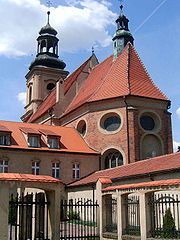
 View from Protestant church to town hall | |
 Flag 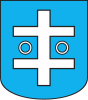 Coat of arms | |
 Wschowa | |
| Coordinates: 51°48′N 16°18′E / 51.800°N 16.300°E | |
| Country | |
| Voivodeship | Lubusz |
| County | Wschowa |
| Gmina | Wschowa |
| Government | |
| • Mayor | Konrad Antkowiak |
| Area | |
| • Total | 8.38 km2 (3.24 sq mi) |
| Population (2019-06-30[1]) | |
| • Total | 13,875 |
| • Density | 1,700/km2 (4,300/sq mi) |
| Time zone | UTC+1 (CET) |
| • Summer (DST) | UTC+2 (CEST) |
| Postal code | 67-400 |
| Car plates | FWS |
| Climate | Dfb |
| Website | https://wschowa.pl |

Wschowa (pronounced Fs-hova [ˈfsxɔva], German: Fraustadt)[2] is a town in the Lubusz Voivodeship in western Poland with 13,875 inhabitants (2019). It is the capital of Wschowa County and a significant tourist site containing many important historical monuments.[3]
History[]
Wschowa was originally a border fortress in a region disputed by the Polish dukes of Silesia and Greater Poland. After German colonists had established a settlement nearby, it received Magdeburg rights around 1250. The Old Polish name Veschow was first mentioned in 1248, while the Middle High German name Frowenstat Civitas first appeared in 1290. Despite forming part of Poland over centuries, the town was shaped by its German-speaking populace until 1945.[4]
After the Silesian Piast dukes had gradually accepted Bohemian suzerainty, King Casimir III the Great in 1343 finally conquered it for Poland. The ziemia Wschowa then was incorporated into the Greater Polish Poznań Voivodeship of the Polish Crown. Since then Fraustadt/Wschowa was a royal town of Poland[5] and the seat of local starosts.
Fraustadt/Wschowa and its Latin school was one of the centres of the Protestant Reformation in Poland and a retreat for religious refugees in the days of the Counter-Reformation in adjacent Habsburg Silesia. In the 17th century, Italian Niccolo Bacaralli established in Fraustadt the first paint manufacture in Poland.[5]
In the 18th century kings Augustus II the Strong and Augustus III of Poland often resided in Fraustadt/Wschowa and the town was even called the "unofficial capital of Poland".[5] The Royal Castle hosted meetings of Polish kings with foreign delegations and even sessions of the Senate of the Polish–Lithuanian Commonwealth were held in Fraustadt/Wschowa.[5] In 1737 a concordat between the Holy See and Poland was signed in Fraustadt/Wschowa.
The Battle of Fraustadt occurred on February 3, 1706, during the Great Northern War, when Swedish forces defeated a joint army of the Polish–Lithuanian Commonwealth, Saxony and Russia. Within the Second Partition of Poland in 1793, the region was annexed by the Kingdom of Prussia and incorporated into the province of South Prussia, until in 1807 it was awarded to the Duchy of Warsaw according to the Treaty of Tilsit.
Jakob Walter, a Napoleonic soldier claimed to have passed through the town in 1806. He claims the town was used as a garrison and had 99 windmills.[6]

A part of the Grand Duchy of Posen from 1815 on, the town was again incorporated into the Prussian Province of Posen in 1848. In 1890, the town had a population of 6,873, of which 500 (7.3%) were Poles.[7] According to the 1919 Treaty of Versailles, Fraustadt remained a part of Germany as it had a majority of German citizens[4] and formed the southernmost district of the Posen-West Prussia border province till 1 October 1938, when the province was dissolved. It became a district center in the Province of Silesia till 1941, from 1941 to 1945 in the Province of Lower Silesia.
Fraustadt was one of the few areas within Germany attacked by the Polish military during the Polish Defensive War in 1939. For a few hours its neighboring village of Geyersdorf (now Dębowa Łęka) was the first German town[citation needed] to be occupied by enemy forces in the war. The other notable attack was carried on the same day by one PZL.23B of the 21st Squadron; the factory in Oława (then Ohlau) was the first victim of a bomb attack onto the German territory. Fraustadt was occupied by the Red Army in February 1945.
After the capitulation of Germany, all remaining inhabitants were expelled westward, ethnically cleansing the town. Initially the town was part of Okręg III (comprising present West Pomeranian and Lubusz provinces) between 1945 and 1946. German monuments were removed from the town by the new authorities, including the Protestant cemetery. Also, in 1968, the remains of the former German-Jewish cemetery were destroyed.[4]


Later, Wschowa was a county (powiat) center in Poznan Voivodeship between 1946 and 1950, then in Zielona Gora Voivodeship between 1950 and 1975. It was finally a commune (gmina) center in Leszno Voivodeship between 1975 and 1999 before the creation of Lubusz province. It became again a county center after 24 years.
Sports[]
Wschowa hosted the 2010 edition of the Polish Sidecarcross Grand Prix.[8]
Notable people[]
- Valerius Herberger (1562–1627), German Lutheran theologian
- Melchior Teschner (1584–1635), German cantor, composer and theologian
- Andreas Gryphius (1616–1664), German Baroque poet, lived at Fraustadt on and off
- Franciszek Antoni Kwilecki (1725–1794), Polish official, starost of Wschowa, deputy to the Great Sejm, which he opened, supporter and signatory of the Constitution of 3 May 1791
- [pl] (1787–1869), Polish officer, November Uprising participant
- Rudolf Ewald Stier (1800–1862), German Protestant theologian
- Florian Stablewski (1841–1906), archbishop, Primate of Poland
- Leo Rosenberg (1879–1963), German jurist
- Fritz Thurm (1883–1937), German resistance fighter
- Alfred Fellisch (1884–1973), German politician
- Bronisław Geremek (1932–2008), historian and politician, attended school at Wschowa
- Waldy Dzikowski (born 1959), politician, born in Wschowa
- Grzegorz Król (born 1978), footballer
- Marcin Warcholak (born 1989), footballer
- (born 2007), footballer
Twin towns – sister cities[]
See twin towns of Gmina Wschowa.
References[]
- ^ "Population. Size and structure and vital statistics in Poland by territorial division in 2019. As of 30th June". stat.gov.pl. Statistics Poland. 2019-10-15. Retrieved 2020-03-22.
- ^ "Former Territory of Germany" (in German). 2017-11-26.
- ^ "Atrakcje turystyczne - Oficjalna Strona Miasta i Gminy Wschowa". www.wschowa.pl. Retrieved 9 January 2018.
- ^ Jump up to: a b c Chwistek, Marek (2003). "Die "steinerne Chronik" von Fraustadt". In Mazur, Zbigniew (ed.). Das deutsche Kultuerbe in den polnischen West- und Nordgebieten. Harrassowitz Verlag. pp. 40–56. ISBN 3-447-04800-X.
- ^ Jump up to: a b c d Łukasz Zalesiński. "Miasto królów, miasto byka". Onet Podróże (in Polish). Retrieved July 26, 2019.
- ^ The Diary of a Napoleonic Foot Soldier by Jakob Walter
- ^ "Deutsche Verwaltungsgeschichte Schlesien, Kreis Fraustadt". treemagic.org. Retrieved 2021-01-19.
- ^ FIM Sidecarcross World Championship - 2010 Calendar Archived 2011-08-12 at the Wayback Machine FIM website, accessed: 30 October 2009
External links[]
| Wikimedia Commons has media related to Wschowa. |
- Official town website
- Jewish Community in Wschowa on Virtual Shtetl
Coordinates: 51°48′N 16°19′E / 51.800°N 16.317°E
| hide | ||
|---|---|---|
| City counties |
|  |
| Land counties | ||

| hide | ||
|---|---|---|
| Town and seat |  | |
| Villages | ||
| show Authority control |
|---|
- Cities and towns in Lubusz Voivodeship
- Wschowa County