Xinyi, Guangdong
Xinyi
信宜市 Sunyi; Hsini | |
|---|---|
 | |
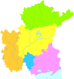 Xinyi is the northernmost division on this map of Maoming | |
 Xinyi Location in Guangdong | |
| Coordinates: 22°21′18″N 110°56′48″E / 22.3549°N 110.9468°ECoordinates: 22°21′18″N 110°56′48″E / 22.3549°N 110.9468°E | |
| Country | People's Republic of China |
| Province | Guangdong |
| Prefecture-level city | Maoming |
| Area | |
| • Total | 3,081 km2 (1,190 sq mi) |
| Population (2010 census) | 913,708 |
| Time zone | UTC+8 (China Standard) |
| Postal code | 525300 |
| Area code(s) | (0)668 |
| License plate prefixes | 粤K |
| Website | www |

| Xinyi | |||
|---|---|---|---|
| Simplified Chinese | 信宜 | ||
| Postal | Sunyi | ||
| |||
Xinyi, alternately romanized as Sunyi,[a] is a county-level city in Guangdong Province, China. It is administered as part of the prefecture-level city of Maoming in the southwestern corner of the province,[2] bordering Guangxi to the west. It has a population of 913,708 people.[when?]
History[]
Under the Qing, Xinyi County formed part of the commandery of Gaozhou.[1] After the Chinese Civil War, it was reörganized under Maoming.
Transportation[]
Schools[]
Xinyi Middle School, the first county school in Xinyi District, was set up in 1916. It is now a national-level model high school.
Districts[]
Climate[]
| showClimate data for Xinyi (1981−2010) |
|---|
Notes[]
References[]
- ^ Jump up to: a b Gützlaff, Charles, China Opened, p. 527.
- ^ F_127. "China's army aviation airdrop necessities to disaster-stricken Xinyi, Guangdong - People's Daily Online". english.peopledaily.com.cn. Retrieved 19 April 2018.
External links[]
- Official website (in Chinese)
| show Authority control |
|---|
This Guangdong location article is a stub. You can help Wikipedia by . |
Categories:
- County-level divisions of Guangdong
- County-level cities in Guangdong
- Maoming
- Guangdong geography stubs