Ébersviller
Ébersviller | |
|---|---|
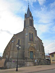 The church in Ébersviller | |
 Coat of arms | |
show Location of Ébersviller | |
 Ébersviller | |
| Coordinates: 49°16′39″N 6°24′12″E / 49.2775°N 6.4033°ECoordinates: 49°16′39″N 6°24′12″E / 49.2775°N 6.4033°E | |
| Country | France |
| Region | Grand Est |
| Department | Moselle |
| Arrondissement | Forbach-Boulay-Moselle |
| Canton | Bouzonville |
| Intercommunality | |
| Government | |
| • Mayor (2020–2026) | Edmond Moritz[1] |
| Area 1 | 14.07 km2 (5.43 sq mi) |
| Population (Jan. 2018)[2] | 951 |
| • Density | 68/km2 (180/sq mi) |
| Time zone | UTC+01:00 (CET) |
| • Summer (DST) | UTC+02:00 (CEST) |
| INSEE/Postal code | 57186 /57320 |
| Elevation | 210–351 m (689–1,152 ft) (avg. 235 m or 771 ft) |
| 1 French Land Register data, which excludes lakes, ponds, glaciers > 1 km2 (0.386 sq mi or 247 acres) and river estuaries. | |


Ébersviller (Lorraine Franconian Ebeschwiller/Ewëschweller, German: Ebersweiler) is a commune in the Moselle department in Grand Est in north-eastern France.
Localities of the commune: Ising (German: Isingen), Férange, Kreschmuhle (German: Kreschmühle), Labrück.
Population[]
| Year | Pop. | ±% |
|---|---|---|
| 2005 | 769 | — |
| 2006 | 787 | +2.3% |
| 2007 | 804 | +2.2% |
| 2008 | 824 | +2.5% |
| 2009 | 844 | +2.4% |
| 2010 | 865 | +2.5% |
| 2011 | 889 | +2.8% |
| 2012 | 886 | −0.3% |
| 2013 | 897 | +1.2% |
| 2014 | 909 | +1.3% |
| 2015 | 921 | +1.3% |
| 2016 | 941 | +2.2% |
See also[]
| Wikimedia Commons has media related to Ébersviller. |
References[]
- ^ "Répertoire national des élus: les maires". data.gouv.fr, Plateforme ouverte des données publiques françaises (in French). 2 December 2020.
- ^ "Populations légales 2018". INSEE. 28 December 2020.
Categories:
- Communes of Moselle (department)
- Forbach-Boulay-Moselle arrondissement geography stubs