Évrange
From Wikipedia, the free encyclopedia
Commune in Grand Est, France
Évrange | |
|---|---|
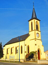 The church in Évrange | |
 Coat of arms | |
 Évrange  Évrange | |
Coordinates:  49°30′07″N 6°11′46″E / 49.502°N 6.196°E / 49.502; 6.196Coordinates: 49°30′07″N 6°11′46″E / 49.502°N 6.196°E / 49.502; 6.196 49°30′07″N 6°11′46″E / 49.502°N 6.196°E / 49.502; 6.196Coordinates: 49°30′07″N 6°11′46″E / 49.502°N 6.196°E / 49.502; 6.196 | |
| Country | France |
| Region | Grand Est |
| Department | Moselle |
| Arrondissement | Thionville |
| Canton | Yutz |
| Intercommunality | Cattenom et environs |
| Government | |
| • Mayor (2020–2026) | Thierry Michel |
| Area 1 | 2.25 km2 (0.87 sq mi) |
| Population (Jan. 2018)[1] | 234 |
| • Density | 100/km2 (270/sq mi) |
| Time zone | UTC+01:00 (CET) |
| • Summer (DST) | UTC+02:00 (CEST) |
| INSEE/Postal code | 57203 /57570 |
| Elevation | 229–272 m (751–892 ft) (avg. 300 m or 980 ft) |
| 1 French Land Register data, which excludes lakes, ponds, glaciers > 1 km2 (0.386 sq mi or 247 acres) and river estuaries. | |

Évrange (French pronunciation: [evʁɑ̃ʒ]; German: Ewringen) is a commune in the Moselle department in Grand Est in north-eastern France.
Transportation[]
Évrange is served by the Route nationale.
See also[]
| Wikimedia Commons has media related to Évrange. |
References[]
- ^ "Populations légales 2018". INSEE. 28 December 2020.
show
| |
|---|---|
| Prefecture |
|
| Subprefectures |
|
| Other |
|
| show Authority control | |
|---|---|
| General |
|
| National libraries | |
This Arrondissement of Thionville geographical article is a stub. You can help Wikipedia by . |
- v
- t
Retrieved from ""
Categories:
- Communes of Moselle (department)
- Thionville arrondissement geography stubs
Hidden categories:
- Articles with short description
- Short description is different from Wikidata
- Infobox mapframe without OSM relation ID on Wikidata
- Coordinates on Wikidata
- Pages using infobox settlement with image map1 but not image map
- Articles containing German-language text
- Commons category link is on Wikidata
- Articles with VIAF identifiers
- Articles with BNF identifiers
- Articles with WorldCat-VIAF identifiers
- All stub articles
- Pages using the Kartographer extension