Pévange
From Wikipedia, the free encyclopedia
Commune in Grand Est, France
Pévange | |
|---|---|
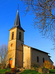 The church in Pévange | |
 Coat of arms | |
 Pévange  Pévange | |
Coordinates:  48°54′30″N 6°37′08″E / 48.9083°N 6.6189°E / 48.9083; 6.6189Coordinates: 48°54′30″N 6°37′08″E / 48.9083°N 6.6189°E / 48.9083; 6.6189 48°54′30″N 6°37′08″E / 48.9083°N 6.6189°E / 48.9083; 6.6189Coordinates: 48°54′30″N 6°37′08″E / 48.9083°N 6.6189°E / 48.9083; 6.6189 | |
| Country | France |
| Region | Grand Est |
| Department | Moselle |
| Arrondissement | Sarrebourg-Château-Salins |
| Canton | Le Saulnois |
| Intercommunality | Communauté de communes du Saulnois |
| Government | |
| • Mayor (2020–2026) | Yannick Chateaux |
| Area 1 | 1.94 km2 (0.75 sq mi) |
| Population (Jan. 2018)[1] | 49 |
| • Density | 25/km2 (65/sq mi) |
| Time zone | UTC+01:00 (CET) |
| • Summer (DST) | UTC+02:00 (CEST) |
| INSEE/Postal code | 57539 /57340 |
| Elevation | 222–259 m (728–850 ft) (avg. 250 m or 820 ft) |
| 1 French Land Register data, which excludes lakes, ponds, glaciers > 1 km2 (0.386 sq mi or 247 acres) and river estuaries. | |

Pévange (French pronunciation: [pevɑ̃ʒ]) is a commune in the Moselle department in Grand Est in north-eastern France.
See also[]
| Wikimedia Commons has media related to Pévange. |
References[]
- ^ "Populations légales 2018". INSEE. 28 December 2020.
show
| |
|---|---|
| Prefecture |
|
| Subprefectures |
|
| Other |
|
This Arrondissement of Sarrebourg-Château-Salins geographical article is a stub. You can help Wikipedia by . |
Retrieved from ""
Categories:
- Communes of Moselle (department)
- Sarrebourg-Château-Salins arrondissement geography stubs
Hidden categories:
- Articles with short description
- Short description is different from Wikidata
- Infobox mapframe without OSM relation ID on Wikidata
- Coordinates on Wikidata
- Pages using infobox settlement with image map1 but not image map
- Commons category link from Wikidata
- Articles with BNF identifiers
- All stub articles
- Pages using the Kartographer extension