Amelécourt
show This article may be expanded with text translated from the corresponding article in French. (June 2015) Click [show] for important translation instructions. |
Amelécourt | |
|---|---|
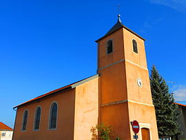 The church in Amelécourt | |
 Coat of arms | |
show Location of Amelécourt | |
 Amelécourt | |
| Coordinates: 48°50′24″N 6°30′08″E / 48.84°N 6.5022°ECoordinates: 48°50′24″N 6°30′08″E / 48.84°N 6.5022°E | |
| Country | France |
| Region | Grand Est |
| Department | Moselle |
| Arrondissement | Sarrebourg-Château-Salins |
| Canton | Le Saulnois |
| Intercommunality | Saulnois |
| Government | |
| • Mayor (2020–2026) | Gérard Chaize[1] |
| Area 1 | 7.56 km2 (2.92 sq mi) |
| Population (Jan. 2018)[2] | 143 |
| • Density | 19/km2 (49/sq mi) |
| Time zone | UTC+01:00 (CET) |
| • Summer (DST) | UTC+02:00 (CEST) |
| INSEE/Postal code | 57018 /57170 |
| Elevation | 202–365 m (663–1,198 ft) (avg. 220 m or 720 ft) |
| 1 French Land Register data, which excludes lakes, ponds, glaciers > 1 km2 (0.386 sq mi or 247 acres) and river estuaries. | |


Amelécourt (German: Almerichshofen) is a commune in the Moselle department in Grand Est in northeastern France.
It is located on the main D674 road, north of the town of Chateau-Salins.
Neighbouring villages include Lubécourt, Gerbécourt, Vaxy, and Salonnes.
Population[]
| Year | Pop. | ±% |
|---|---|---|
| 1962 | 113 | — |
| 1968 | 114 | +0.9% |
| 1975 | 113 | −0.9% |
| 1982 | 119 | +5.3% |
| 1990 | 102 | −14.3% |
| 1999 | 117 | +14.7% |
| 2006 | 139 | +18.8% |
| 2009 | 146 | +5.0% |
See also[]
References[]
- ^ "Répertoire national des élus: les maires". data.gouv.fr, Plateforme ouverte des données publiques françaises (in French). 2 December 2020.
- ^ "Populations légales 2018". INSEE. 28 December 2020.
| Wikimedia Commons has media related to Amelécourt. |
Categories:
- Communes of Moselle (department)
- Sarrebourg-Château-Salins arrondissement geography stubs