Rurange-lès-Thionville
From Wikipedia, the free encyclopedia
Commune in Grand Est, France
Rurange-lès-Thionville | |
|---|---|
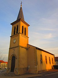 The church in Rurange-lès-Thionville | |
 Coat of arms | |
 Rurange-lès-Thionville  Rurange-lès-Thionville | |
Coordinates:  49°16′40″N 6°14′01″E / 49.2778°N 6.2336°E / 49.2778; 6.2336Coordinates: 49°16′40″N 6°14′01″E / 49.2778°N 6.2336°E / 49.2778; 6.2336 49°16′40″N 6°14′01″E / 49.2778°N 6.2336°E / 49.2778; 6.2336Coordinates: 49°16′40″N 6°14′01″E / 49.2778°N 6.2336°E / 49.2778; 6.2336 | |
| Country | France |
| Region | Grand Est |
| Department | Moselle |
| Arrondissement | Thionville |
| Canton | Metzervisse |
| Intercommunality | |
| Government | |
| • Mayor (2020–2026) | Pierre Rosaire |
| Area 1 | 8.87 km2 (3.42 sq mi) |
| Population (Jan. 2018)[1] | 2,462 |
| • Density | 280/km2 (720/sq mi) |
| Time zone | UTC+01:00 (CET) |
| • Summer (DST) | UTC+02:00 (CEST) |
| INSEE/Postal code | 57602 /57310 |
| Elevation | 159–231 m (522–758 ft) (avg. 202 m or 663 ft) |
| 1 French Land Register data, which excludes lakes, ponds, glaciers > 1 km2 (0.386 sq mi or 247 acres) and river estuaries. | |

Rurange-lès-Thionville (French pronunciation: [ʁyʁɑ̃ʒ lɛ tjɔ̃vil], literally Rurange near Thionville; German: Rörchingen) is a commune in the Moselle department in Grand Est in north-eastern France.
See also[]
| Wikimedia Commons has media related to Rurange-lès-Thionville. |
References[]
- ^ "Populations légales 2018". INSEE. 28 December 2020.
show
| |
|---|---|
| Prefecture |
|
| Subprefectures |
|
| Other |
|
This Arrondissement of Thionville geographical article is a stub. You can help Wikipedia by . |
- v
- t
Retrieved from ""
Categories:
- Communes of Moselle (department)
- Thionville arrondissement geography stubs
Hidden categories:
- Articles with short description
- Short description is different from Wikidata
- Infobox mapframe without OSM relation ID on Wikidata
- Coordinates on Wikidata
- Pages using infobox settlement with image map1 but not image map
- Articles containing German-language text
- Commons category link from Wikidata
- Articles with BNF identifiers
- All stub articles
- Pages using the Kartographer extension