Béning-lès-Saint-Avold
Béning-lès-Saint-Avold | |
|---|---|
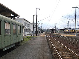 The railway station in Béning-lès-Saint-Avold | |
 Coat of arms | |
show Location of Béning-lès-Saint-Avold | |
 Béning-lès-Saint-Avold | |
| Coordinates: 49°07′58″N 6°50′24″E / 49.1328°N 6.84°ECoordinates: 49°07′58″N 6°50′24″E / 49.1328°N 6.84°E | |
| Country | France |
| Region | Grand Est |
| Department | Moselle |
| Arrondissement | Forbach-Boulay-Moselle |
| Canton | Freyming-Merlebach |
| Intercommunality | Freyming-Merlebach |
| Government | |
| • Mayor (2020–2026) | Simone Ramsaier[1] |
| Area 1 | 3.69 km2 (1.42 sq mi) |
| Population (Jan. 2018)[2] | 1,146 |
| • Density | 310/km2 (800/sq mi) |
| Time zone | UTC+01:00 (CET) |
| • Summer (DST) | UTC+02:00 (CEST) |
| INSEE/Postal code | 57061 /57800 |
| Elevation | 202–337 m (663–1,106 ft) |
| 1 French Land Register data, which excludes lakes, ponds, glaciers > 1 km2 (0.386 sq mi or 247 acres) and river estuaries. | |


Béning-lès-Saint-Avold (French pronunciation: [benɛ̃ lɛ sɛ̃t‿avɔl], German: Beningen bei Sankt Avold) is a commune in the Moselle department in Grand Est in northeastern France.
Population[]
| Year | Pop. | ±% |
|---|---|---|
| 1962 | 1,149 | — |
| 1968 | 1,203 | +4.7% |
| 1975 | 1,328 | +10.4% |
| 1982 | 1,368 | +3.0% |
| 1990 | 1,256 | −8.2% |
| 1999 | 1,231 | −2.0% |
| 2004 | 1,230 | −0.1% |
| 2009 | 1,233 | +0.2% |
| 2014 | 1,155 | −6.3% |
| 2015 | 1,147 | −0.7% |
See also[]
References[]
- ^ "Répertoire national des élus: les maires". data.gouv.fr, Plateforme ouverte des données publiques françaises (in French). 2 December 2020.
- ^ "Populations légales 2018". INSEE. 28 December 2020.
| Wikimedia Commons has media related to Béning-lès-Saint-Avold. |
| show Authority control |
|---|
Categories:
- Communes of Moselle (department)
- Forbach-Boulay-Moselle arrondissement geography stubs