Sainte-Marie-aux-Chênes
Sainte-Marie-aux-Chênes | |
|---|---|
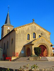 The church in Sainte-Marie-aux-Chênes | |
 Coat of arms | |
show Location of Sainte-Marie-aux-Chênes | |
 Sainte-Marie-aux-Chênes | |
| Coordinates: 49°11′32″N 6°00′11″E / 49.1922°N 6.0031°ECoordinates: 49°11′32″N 6°00′11″E / 49.1922°N 6.0031°E | |
| Country | France |
| Region | Grand Est |
| Department | Moselle |
| Arrondissement | Metz |
| Canton | Rombas |
| Intercommunality | Pays Orne-Moselle |
| Government | |
| • Mayor (2020–2026) | Sylvie Lamarque[1] |
| Area 1 | 10.19 km2 (3.93 sq mi) |
| Population (Jan. 2018)[2] | 4,289 |
| • Density | 420/km2 (1,100/sq mi) |
| Time zone | UTC+01:00 (CET) |
| • Summer (DST) | UTC+02:00 (CEST) |
| INSEE/Postal code | 57620 /57255 |
| Elevation | 205–323 m (673–1,060 ft) (avg. 290 m or 950 ft) |
| 1 French Land Register data, which excludes lakes, ponds, glaciers > 1 km2 (0.386 sq mi or 247 acres) and river estuaries. | |


Sainte-Marie-aux-Chênes (French pronunciation: [sɛ̃t maʁi o ʃɛn]; German: Marieneichen) is a commune in the Moselle department in Grand Est in north-eastern France.
Coat of arms[]
The town's name means "Saint Mary at the oaks" in French, and the town's coat of arms can be described as canting: Azure an oak tree eradicated or, between two letters S and M of the last.
See also[]
Communes of the Moselle department
References[]
| Wikimedia Commons has media related to Sainte-Marie-aux-Chênes. |
- ^ "Répertoire national des élus: les maires". data.gouv.fr, Plateforme ouverte des données publiques françaises (in French). 2 December 2020. Retrieved 7 December 2020.
- ^ "Populations légales 2018". INSEE. 28 December 2020.
| show Authority control |
|---|
Categories:
- Communes of Moselle (department)
- Metz arrondissement geography stubs