Ahe Airport
Ahe Airport Aérodrome de Ahé | |||||||||||
|---|---|---|---|---|---|---|---|---|---|---|---|
| Summary | |||||||||||
| Airport type | Public | ||||||||||
| Operator | DSEAC Polynésie Française | ||||||||||
| Serves | Ahe | ||||||||||
| Location | Ahe, Tuamotu, French Polynesia | ||||||||||
| Elevation AMSL | 3 m / 10 ft | ||||||||||
| Coordinates | 14°25′41″S 146°15′25″W / 14.42806°S 146.25694°WCoordinates: 14°25′41″S 146°15′25″W / 14.42806°S 146.25694°W | ||||||||||
| Map | |||||||||||
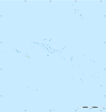 AHE Location of the airport in French Polynesia | |||||||||||
| Runways | |||||||||||
| |||||||||||
Source: French AIP.[1] | |||||||||||
Ahe Airport (IATA: AHE, ICAO: NTHE) is an airport on Ahe (Tenukupara), an atoll in French Polynesia (IATA: AHE, ICAO: NTHE).
Airlines and destinations[]
| Airlines | Destinations |
|---|---|
| Air Tahiti[2] | Arutua, Manihi, Papeete |
Statistics[]
Annual passenger traffic at AHE airport.
See source Wikidata query.
See also[]
List of airports in French Polynesia
References[]
- ^ NTHE – Ahe. AIP from French Service d'information aéronautique, effective 27 January 2022.
- ^ "Download forecast schedule - Official website - Air Tahiti".
External links[]
Tuamotus Gambiers | Islands/Atolls |
| |||||
|---|---|---|---|---|---|---|---|
| Island groups | |||||||
This article about an Oceanian airport is a stub. You can help Wikipedia by . |
This French Polynesia-related geography article is a stub. You can help Wikipedia by . |
Categories:
- Airports in French Polynesia
- Atolls of the Tuamotus
- Oceanian airport stubs
- French Polynesia geography stubs