Le Touquet – Côte d'Opale Airport
Le Touquet - Côte d'Opale Airport Aéroport de Le Touquet - Côte d'Opale | |||||||||||
|---|---|---|---|---|---|---|---|---|---|---|---|
| Summary | |||||||||||
| Airport type | Public | ||||||||||
| Operator | Société d'economie mixte de l'aéroport du Touquet (SEMAT) | ||||||||||
| Serves | Le Touquet, France | ||||||||||
| Elevation AMSL | 21 ft / 6 m | ||||||||||
| Coordinates | 50°30′53″N 001°37′39″E / 50.51472°N 1.62750°E | ||||||||||
| Website | aeroport-letouquet.com | ||||||||||
| Maps | |||||||||||
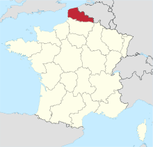 Location of Nord-Pas-de-Calais region in France | |||||||||||
 LFAT Location of airport in Nord-Pas-de-Calais region | |||||||||||
| Runways | |||||||||||
| |||||||||||

Le Touquet – Côte d'Opale Airport (French: Aéroport de Le Touquet - Côte d'Opale) (IATA: LTQ, ICAO: LFAT) is 2.9 kilometres (1.8 mi) east-southeast of Le Touquet,[1] a commune of the Pas-de-Calais department on the coast of northern France.
The passenger terminal is open from 09:00-20:00 hours. There are three flying clubs and most of them also give flying lessons; two of them are helicopter schools and clubs.
Airlines and destinations[]
As of November 2018, there are no more scheduled services after the only operator, LyddAir, ceased its route to Lydd.
Statistics[]
See source Wikidata query and sources.
Accidents and incidents[]
- On 2 May 1981, Aer Lingus Flight 164, a Boeing 737-200 carrying 108 passengers and crew, was hijacked on a flight from Dublin Airport in Ireland to London Heathrow Airport in the United Kingdom. The hijacker had the pilots fly the aircraft to Le Touquet where it then stood for nearly 10 hours before French armed forces troops stormed the aircraft and apprehended the suspect. No one was killed or injured.
Appearances in media[]
- Le Touquet airport is featured in the Microsoft Flight Simulator X mission Flying Blind Across The Channel, in which the player flies a Cessna 172 from Manston Airport in Kent, UK on a foggy day using instrument flight rules.[citation needed]
References[]
- ^ Jump up to: a b LFAT – LE TOUQUET PARIS PLAGE. AIP from French Service d'information aéronautique, effective 9 September 2021.
External links[]
- Aéroport Le Touquet Côte d'Opale - official site
- (in French) Aéroport de Le Touquet - Côte d'Opale (LTQ / LFAT) at Union des Aéroports Français
- Accident history for LTQ at Aviation Safety Network
This French airport-related article is a stub. You can help Wikipedia by . |
Categories:
- Airports in Hauts-de-France
- Le Touquet
- French airport stubs