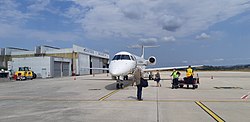
Castres–Mazamet Airport
Castres - Mazamet Airport Aéroport de Castres - Mazamet | |||||||||||
|---|---|---|---|---|---|---|---|---|---|---|---|
 | |||||||||||
| Summary | |||||||||||
| Airport type | Public | ||||||||||
| Operator | CCI Castres-Mazamet | ||||||||||
| Serves | Castres / Mazamet | ||||||||||
| Location | Labruguière, Tarn, France | ||||||||||
| Elevation AMSL | 785 ft / 239 m | ||||||||||
| Coordinates | 43°33′18″N 002°17′26″E / 43.55500°N 2.29056°E | ||||||||||
| Map | |||||||||||
 DCM Location of the Airport in France | |||||||||||
| Runways | |||||||||||
| |||||||||||

Castres – Mazamet Airport (French: Aéroport de Castres - Mazamet) (IATA: DCM, ICAO: LFCK) is an airport serving Castres and Mazamet[1] and the east of Midi-Pyrénées. The airport is located 7 km (4 mi) southeast of Castres[1] and northwest of Mazamet, near the commune of Labruguière, in the Tarn department.
Facilities[]
The airport resides at an elevation of 239 metres (784 ft) above mean sea level. It has one paved runway designated 14/32 which measures 1,825 by 30 metres (5,988 ft × 98 ft).[1] The airport is VFR and IFR compliant.
Airlines and destinations[]
| Airlines | Destinations |
|---|---|
| Air France Hop | Paris–Orly |
Statistics[]
See source Wikidata query and sources.
References[]
- ^ Jump up to: a b c d LFCK – CASTRES MAZAMET. AIP from French Service d'information aéronautique, effective 9 September 2021.
- ^ (in French) Aéroport de Castres - Mazamet Archived 2007-01-10 at the Wayback Machine at Union des Aéroports Français
- ^ Airport information for LFCK from DAFIF (effective October 2006)
- ^ Airport information for DCM at Great Circle Mapper. Source: DAFIF (effective October 2006).
External links[]
| show Authority control |
|---|
This French airport-related article is a stub. You can help Wikipedia by . |
Categories:
- Airports in Occitanie
- Buildings and structures in Tarn (department)
- Airports established in 1990
- 1990 establishments in France
- French airport stubs