Poitiers–Biard Airport
Poitiers–Biard Airport Aéroport de Poitiers – Biard | |||||||||||||||||||
|---|---|---|---|---|---|---|---|---|---|---|---|---|---|---|---|---|---|---|---|
| Summary | |||||||||||||||||||
| Airport type | Public | ||||||||||||||||||
| Operator | CCI Vienne | ||||||||||||||||||
| Serves | Poitiers, France | ||||||||||||||||||
| Location | Biard | ||||||||||||||||||
| Elevation AMSL | 423 ft / 129 m | ||||||||||||||||||
| Coordinates | 46°35′15″N 000°18′24″E / 46.58750°N 0.30667°ECoordinates: 46°35′15″N 000°18′24″E / 46.58750°N 0.30667°E | ||||||||||||||||||
| Website | www | ||||||||||||||||||
| Map | |||||||||||||||||||
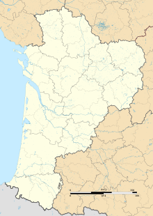
 LFBI Location in Nouvelle-Aquitaine region | |||||||||||||||||||
| Runways | |||||||||||||||||||
| |||||||||||||||||||
Poitiers–Biard Airport (French: Aéroport de Poitiers – Biard, IATA: PIS[2], ICAO: LFBI) is an airport located at Biard, 2.4 kilometres (1.5 mi) west of Poitiers,[1] in the Vienne department of the Nouvelle-Aquitaine region in France.
Facilities[]
The airport stands at an elevation of 423 feet (129 m) above mean sea level. It has one paved runway designated 03/21 which measures 2,350 by 45 metres (7,710 ft × 148 ft). It also has a two parallel grass runways: 03R/21L measuring 1,200 by 100 metres (3,937 ft × 328 ft) and 03L/21R measuring 1,200 by 100 metres (3,937 ft × 328 ft). The longer grass runway is for use by glider aircraft.[1]
Airlines and destinations[]
| Airlines | Destinations |
|---|---|
| Air France Hop | Seasonal: Ajaccio |
| Chalair Aviation | La Rochelle, Lyon Seasonal: Ajaccio[3] |
| Ryanair | Edinburgh, Lisbon, London–Stansted |
Statistics[]
Annual passenger traffic at PIS airport.
See source Wikidata query.
References[]
- ^ a b c LFBI – POITIERS BIARD. AIP from French Service d'information aéronautique, effective 27 January 2022.
- ^ "IATA Location Code Search (PIS – City: Poitiers, Airport: Biard)". International Air Transport Association. Retrieved 22 December 2012.
- ^ "Chalair adds Poitiers – Ajaccio sector in S20".
External links[]
- Aéroport de Poitiers-Biard (official site) (in French)
- Aéroport de Poitiers-Biard (Union des Aéroports Français) (in French)
- Aeronautical chart and airport information for LFBI at SkyVector
- Current weather for LFBI at NOAA/NWS
- Accident history for PIS at Aviation Safety Network
Categories:
- Airports in Nouvelle-Aquitaine
- Buildings and structures in Vienne
- Airports established in 1924
- 1924 establishments in France
