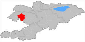
Aksy District
Aksy
Аксы району | |
|---|---|
 | |
 | |
| Country | Kyrgyzstan |
| Region | Jalal-Abad Region |
| Area | |
| • Total | 4,578 km2 (1,768 sq mi) |
| Population (2021) | |
| • Total | 137,103 |
| • Density | 30/km2 (78/sq mi) |
| Time zone | UTC+6 |
Aksy (Kyrgyz: Аксы району) is a district of Jalal-Abad Region in western Kyrgyzstan. The seat lies at Kerben.[1] Its area is 4,578 km2 (1,768 sq mi),[2] and its resident population was 137,103 in 2021.[3]
History[]
Aksy District was established in 1936 as Tash-Kömür District. In 1943, when Tash-Kömür was given city status, the district was renamed Jangy-Jol District, and the administrative seat was moved to the village Jangy-Jol. It absorbed the Kerben District in 1958 (seat moved to Kerben), and Ala-Buka and Chatkal Districts in 1963. Ala-Buka and Chatkal Districts were re-established in 1969. In 1991 Jangy-Jol District was renamed into Aksy District.[4]
Population[]
| Year | Pop. | ±% p.a. |
|---|---|---|
| 1970 | 49,397 | — |
| 1979 | 60,404 | +2.26% |
| 1989 | 75,602 | +2.27% |
| 1999 | 94,631 | +2.27% |
| 2009 | 113,010 | +1.79% |
| 2021 | 137,103 | +1.62% |
| Note: resident population; Sources:[2][3] | ||
Populated places[]
In total, Aksy District includes 1 town and 68 villages in 11 rural communities (ayyl aymagy). Each rural community can consist of one or several villages. The rural communities and settlements in the Aksy District are:[1][5]
- The town of Kerben (incl. Kurulush, Kuluk-Döbö, Ak-Döbö, Jetigen, Mamay and Ustukan)
- Ak-Jol (seat: Ak-Jol; incl. Jolborstu, Kara-Tyt, Kechüü, Raykomol, Tegene, Kyzyl-Beyit, Kürp and Razan-Say)
- Ak-Suu (seat: Ak-Suu; incl. Ak-Say, Korgon-Döbö, Kum-Bulung, Mor-Bulak, Töö-Basty)
- Avletim (seat: Avletim; incl. Baykashka-Terek, Deres-Say, Janggaktuu-Bulak, It-Agar, Korgon, Mukur, Tegirmen-Say and Tovar-Say)
- Jangy-Jol (seat: Jangy-Jol; incl. Koy-Tash, Tashtak and Ters)
- Jerge-Tal (seat: Jerge-Tal; incl. Bospiek and Kyzyl-Kapchygay)
- Kara-Jygach (seat: Kara-Jygach; incl. Dardak-Döbö, Kara-Oy, Syny, Tor-Kamysh and Charba)
- Kara-Suu (seat: Top-Janggak; incl. Juzumjan, Kara-Suu, Kezart, Kyzyl-Köl, Say-Bulung, Türdük, Chaldybar and Chat)
- Kashka-Suu (seat: Kashka-Suu; incl. Jangy-Ayyl, Kara-Döbö, Sogot, Tostu, Tuyuk-Jar, Ölöng-Bulak, Charbak and Kara-Bashat)
- Kyzyl-Tuu (seat: Kyzyl-Tuu; incl. Arkyt, Jylgyn and Jol-Say)
- Mavlyanov (seat: Atana; incl. Munduz, Sary-Kashka, Semet, Toruk, Uluk, Chie, Tash-Jar and Janggak)
- Nazaraliev (seat: Kyzyl-Jar; incl. Jyl-Kol, Kum and Naryn)
Prominent people from the Aksy district[]
There were several prominent people from the Aksy area of the Jalal-Abad region in Kyrgyzstan.
In the 19th century: prominent statesman Nuzup Mingbashy (Yusuf Mingbashi) of the Kokand khanate, poet Jengijok, etc.
In the 20th century: a poet Temirkul Umetaliev, a writer Tologon Kasymbekov, etc.
At the end of the 20th century - beginning of the 21st century: politicians Topchubek Turgunaliev, Azimbek Beknazarov, a historian Tashmanbet Kenensariev, a journalist Uran Toktonazarovich Botobekov, etc.
References[]
- ^ a b "Classification system of territorial units of the Kyrgyz Republic" (in Kyrgyz). National Statistics Committee of the Kyrgyz Republic. May 2021. pp. 20–22.
- ^ a b "2009 population and housing census of the Kyrgyz Republic: Jalal-Abad Region" (PDF) (in Russian). National Statistics Committee of the Kyrgyz Republic. 2010. pp. 13, 17.
- ^ a b "Population of regions, districts, towns, urban-type settlements, rural communities and villages of Kyrgyz Republic" (XLS) (in Russian). National Statistics Committee of the Kyrgyz Republic. 2021. Archived from the original on 10 November 2021.
- ^ "Аксы району" [Aksy District] (PDF). Кыргызстандын Географиясы [Geography of Kyrgyzstan] (in Kyrgyz). Bishkek. 2004. p. 473.
- ^ "List of rural communities of Kyrgyzstan". Archived from the original on 2010-02-09. Retrieved 2010-04-14.
| North Kyrgyzstan |
|  | ||||||||||
|---|---|---|---|---|---|---|---|---|---|---|---|---|
| South Kyrgyzstan |
| |||||||||||
Places adjacent to Aksy District | |
|---|---|
Coordinates: 41°30′N 71°45′E / 41.500°N 71.750°E

This Jalal-Abad region location article is a stub. You can help Wikipedia by . |
- Districts of Jalal-Abad Region
- Jalal-Abad geography stubs