Naryn District
Naryn District | |
|---|---|
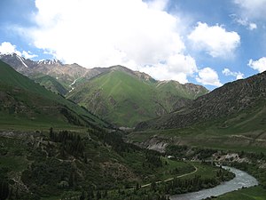 Countryside in Naryn District near Naryn | |
 | |
| Country | Kyrgyzstan |
| Region | Naryn Region |
| Area | |
| • Total | 10,502 km2 (4,055 sq mi) |
| Population (2021)[1] | |
| • Total | 49,955 |
| • Density | 4.8/km2 (12/sq mi) |
| Time zone | UTC+6 |
Naryn District (formerly Tian'-Shan' District) is a district of Naryn Region in central-southern Kyrgyzstan. The administrative seat lies at the city Naryn, which is not part of the district.[2] Naryn District was established in its borders in 1930. It borders with At-Bashy District to the south, Ak-Talaa District to the west, Kochkor District to the north, Tong District to the north-east, Jeti-Ögüz District to the east, and Lake Song Köl to the north-west. Its area is 10,502 km2 (4,055 sq mi),[3] and its resident population was 49,955 in 2021.[1]
The district is characterized by the scenic Tian Shan Mountains, alpine pastures and Lake Song Köl which during summer months attracts large herds of sheep and horses with their herders and their yurts.
Economy[]
The economy of Naryn oblast is dominated by animal herding (sheep, horses, yaks), with wool and meat as the main products. Mining of various minerals developed during the Soviet era has largely been abandoned as uneconomical. Today the area is considered to be the poorest region in the country.
Demographics[]
| Year | Pop. | ±% |
|---|---|---|
| 1970 | 30,487 | — |
| 1979 | 34,089 | +11.8% |
| 1989 | 36,863 | +8.1% |
| 1999 | 40,628 | +10.2% |
| 2009 | 44,080 | +8.5% |
| 2021 | 49,955 | +13.3% |
| Note: resident population; Sources:[3][1] | ||
According to the 2009 Census, the ethnic composition (de jure population) of the Naryn District was 99.8% Kyrgyz and 0.2% other groups.[3]
Populated places[]
In total, Naryn District includes 39 settlements in 15 rural communities (ayyl aymagy). The rural communities and settlements in the Naryn District are:[2][4][5]
- Ak-Kuduk (seat: Segizinchi Mart; incl. Ak-Kuduk and Shoro)
- Chet-Nura (seat: Orto-Nura; incl. Ak-Bulung, Ak-Kyya, Iyri-Suu, Orto-Saz, Örük-Tam, Chet-Nura and Tösh-Bulak)
- Döbölü (seat: Döbölü; incl. Alysh and Kengesh)
- Dostuk (seat: Dostuk)
- Emgekchil (seat: Emgekchil)
- Emgek-Talaa (seat: Ak-Talaa; incl. Tegerek and Emgek-Talaa)
- Jan-Bulak (seat: Jan-Bulak)
- Jerge-Tal (seat: Jerge-Tal; incl. Jalgyz-Terek and Kyzyl-Jyldyz)
- Kara-Kujur (seat: Lakol; incl. Jer-Köchkü)
- Kazan-Kuygan (seat: Kazan-Kuygan; incl. Kara-Üngkür)
- Ming-Bulak (seat: Kuybyshev; incl. Ming-Bulak and Örnök)
- On-Archa (seat: Echki-Bashy; incl. Ottuk)
- Ortok (seat: Tash-Bashat, incl. Kayyngdy, Örük-Tam, Eki-Naryn and Tamdy-Suu)
- Sary-Oy (seat: Jylan-Aryk; incl. Sary-Oy)
- Uchkun (seat: Kulanak; incl. Uchkun)
References[]
- ^ a b c "Population of regions, districts, towns, urban-type settlements, rural communities and villages of Kyrgyz Republic" (XLS) (in Russian). National Statistics Committee of the Kyrgyz Republic. 2021. Archived from the original on 10 November 2021.
- ^ a b "Classification system of territorial units of the Kyrgyz Republic" (in Kyrgyz). National Statistics Committee of the Kyrgyz Republic. May 2021. pp. 37–39.
- ^ a b c "2009 population and housing census of the Kyrgyz Republic: Naryn Region" (PDF) (in Russian). National Statistics Committee of the Kyrgyz Republic. 2010. pp. 12, 15, 40.
- ^ List of rural communities of Kyrgyzstan Archived 2010-02-09 at the Wayback Machine
- ^ Law 27 September 2012 No. 168 on the transformation of individual urban settlements of the Kyrgyz Republic and relating them to the category of village or city
| North Kyrgyzstan |
|  | ||||||||||
|---|---|---|---|---|---|---|---|---|---|---|---|---|
| South Kyrgyzstan |
| |||||||||||
Places adjacent to Naryn District | |
|---|---|

- Districts of Naryn Region