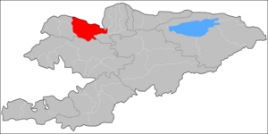
Talas District, Kyrgyzstan
Talas | |
|---|---|
 | |
| Country | Kyrgyzstan |
| Region | Talas Region |
| Area | |
| • Total | 5,051 km2 (1,950 sq mi) |
| Population (2021)[1] | |
| • Total | 70,642 |
| • Density | 14/km2 (36/sq mi) |
| Time zone | UTC+6 |
Talas (Kyrgyz: Талас району, romanised: Talas rayonu) is a district of Talas Region in north-western Kyrgyzstan. Its area is 5,051 square kilometres (1,950 sq mi),[2] and its resident population was 70,642 in 2021.[1] The administrative seat lies at Manas.[3]
Demographics[]
Its population, according to the Population and Housing Census of 2009, was 58,867. All of them live in rural areas.[2]
| Year | Pop. | ±% |
|---|---|---|
| 1970 | 36,817 | — |
| 1979 | 43,423 | +17.9% |
| 1989 | 48,252 | +11.1% |
| 1999 | 50,068 | +3.8% |
| 2009 | 58,867 | +17.6% |
| 2021 | 70,642 | +20.0% |
| Note: resident population; Sources:[2][1] | ||
Ethnic composition[]
According to the 2009 Census, the ethnic composition of the Talas District (de jure population) was:[2]
| Ethnic group | Population | Proportion of Talas District population |
|---|---|---|
| Kyrgyzs | 58,867 | 99.3% |
| Russians | 170 | 0.3% |
| other groups | 249 | 0.4% |
Rural communities and villages[]
In total, Talas District include 27 settlements in 13 rural communities (ayyl aymagy). Each rural community can consist of one or several villages. The rural communities and settlements in the Talas District are:[3][4]
- Aral (seat: Aral)
- Aydaraliev (seat: Köpürö-Bazar)
- Bekmoldoev (seat: Sasyk-Bulak; incl. Kara-Oy, Kengesh and Chong-Tokoy)
- Berdike Baatyr (seat: Kum-Aryk; incl. Kozuchak and Arashan)
- Dolon (seat: Tash-Aryk; incl. Ak-Jar and Orto-Aryk)
- Jerge-Tal (seat: Kyzyl-Tuu; incl. Chyyyrchyk and Kök-Kashat)
- Kalba (seat: Kalba; incl. Atay Ogonbaev, Balbal and Besh-Tash)
- Kara-Suu (seat: Kara-Suu)
- Kök-Oy (seat: Kök-Oy)
- Kuugandy (seat: Üch-Emchek)
- Nurjanov (seat: Jon-Aryk; incl. Kök-Tokoy)
- Ömüraliev (seat: Manas; incl. Chat-Bazar)
- Osmonkulov (seat: Taldy-Bulak; incl. Ak-Korgon)
References[]
- ^ a b c "Population of regions, districts, towns, urban-type settlements, rural communities and villages of Kyrgyz Republic" (XLS) (in Russian). National Statistics Committee of the Kyrgyz Republic. 2021. Archived from the original on 10 November 2021.
- ^ a b c d "2009 population and housing census of the Kyrgyz Republic: Talas Region" (PDF) (in Russian). National Statistics Committee of the Kyrgyz Republic. 2010. pp. 12, 15, 38.
- ^ a b "Classification system of territorial units of the Kyrgyz Republic" (in Kyrgyz). National Statistics Committee of the Kyrgyz Republic. May 2021. pp. 66–67.
- ^ List of rural communities of Kyrgyzstan Archived 2010-02-09 at the Wayback Machine
| North Kyrgyzstan |
|  | ||||||||||
|---|---|---|---|---|---|---|---|---|---|---|---|---|
| South Kyrgyzstan |
| |||||||||||
Coordinates: 42°31′N 72°14′E / 42.517°N 72.233°E

This Talas Region location article is a stub. You can help Wikipedia by . |
- Districts of Talas Region
- Kyrgyzstan geography stubs