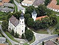
Bánhorváti
Bánhorváti | |
|---|---|
Village | |
 | |
 Flag  Coat of arms | |
 Bánhorváti Location of Bánhorváti | |
| Coordinates: 48°13′31″N 20°30′16″E / 48.22525°N 20.50441°ECoordinates: 48°13′31″N 20°30′16″E / 48.22525°N 20.50441°E | |
| Country | Hungary |
| Region | Northern Hungary |
| County | Borsod-Abaúj-Zemplén |
| District | Kazincbarcika |
| Area | |
| • Total | 28.47 km2 (10.99 sq mi) |
| Population (1 January 2015)[1] | |
| • Total | 1,373 |
| • Density | 48/km2 (120/sq mi) |
| Time zone | UTC+1 (CET) |
| • Summer (DST) | UTC+2 (CEST) |
| Postal code | 3642 |
| Area code | (+36) 48 |
| Website | www |

Bánhorváti is a village in Borsod-Abaúj-Zemplén county, Hungary. It appeared after and merged in 1950.

References[]
- ^ "Gazetteer of Hungary, 1st January 2015" (in Hungarian). Hungarian Central Statistical Office. 3 September 2015. Retrieved 4 September 2015.
External links[]
- Official webpage of Bánhorváti
- Street map (in Hungarian)


This Borsod-Abaúj-Zemplén location article is a stub. You can help Wikipedia by . |
Categories:
- Populated places in Borsod-Abaúj-Zemplén County
- Borsod-Abaúj-Zemplén geography stubs