Szomolya
Szomolya | |
|---|---|
 Flag  Coat of arms | |
 Szomolya Location of Szomolya | |
| Coordinates: 47°53′31″N 20°29′47″E / 47.89194°N 20.49637°ECoordinates: 47°53′31″N 20°29′47″E / 47.89194°N 20.49637°E | |
| Country | |
| County | Borsod-Abaúj-Zemplén |
| Area | |
| • Total | 22.69 km2 (8.76 sq mi) |
| Population (2004) | |
| • Total | 1,723 |
| • Density | 75.93/km2 (196.7/sq mi) |
| Time zone | UTC+1 (CET) |
| • Summer (DST) | UTC+2 (CEST) |
| Postal code | 3411 |
| Area code(s) | 49 |

Szomolya is a village in Borsod-Abaúj-Zemplén county, Hungary.
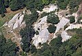
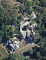
Gallery[]

External links[]
- Street map (in Hungarian)
- Aerial photographs of Szomolya


This Borsod-Abaúj-Zemplén location article is a stub. You can help Wikipedia by . |
Categories:
- Populated places in Borsod-Abaúj-Zemplén County
- Borsod-Abaúj-Zemplén geography stubs