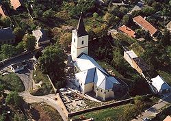
Mád
show This article may be expanded with text translated from the corresponding article in Hungarian. (December 2009) Click [show] for important translation instructions. |
Mád
מאדע (in Yiddish) | |
|---|---|
Village | |
 | |
 Flag  Coat of arms | |
 Mád Location of Mád | |
| Coordinates: 48°11′23″N 21°16′36″E / 48.18981°N 21.27653°ECoordinates: 48°11′23″N 21°16′36″E / 48.18981°N 21.27653°E | |
| Country | Hungary |
| Region | Northern Hungary |
| County | Borsod-Abaúj-Zemplén |
| District | Szerencs |
| Area | |
| • Total | 31.86 km2 (12.30 sq mi) |
| Population (1 January 2015)[1] | |
| • Total | 2,217 |
| • Density | 70/km2 (180/sq mi) |
| Time zone | UTC+1 (CET) |
| • Summer (DST) | UTC+2 (CEST) |
| Postal code | 3909 |
| Area code | (+36) 47 |
| Website | www |

Mád (Yiddish: מאדע Made) is a village in Borsod-Abaúj-Zemplén County in northeastern Hungary.[2]
The former Jewish synagogue in Mád was restored between 2000 and 2004 with aid from the World Monuments Fund.[3]
References[]
- ^ "Gazetteer of Hungary, 1st January 2015" (in Hungarian). Hungarian Central Statistical Office. 3 September 2015. Retrieved 4 September 2015.
- ^ Központi Statisztikai Hivatal (KSH) (in Hungarian)
- ^ Mád Synagogue, World Monuments Fund accessed in Feb. 11, 2018.


This Hungarian geography article is a stub. You can help Wikipedia by . |
This Borsod-Abaúj-Zemplén location article is a stub. You can help Wikipedia by . |
Categories:
- Populated places in Borsod-Abaúj-Zemplén County
- Hungary geography stubs
- Borsod-Abaúj-Zemplén geography stubs