Kánó
From Wikipedia, the free encyclopedia
show This article may be expanded with text translated from the corresponding article in Hungarian. (December 2009) Click [show] for important translation instructions.
|
Village in Northern Hungary, Hungary
Kánó | |
|---|---|
Village | |
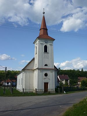 Kánói református templom | |
| Country | |
| Regions | Northern Hungary |
| County | Borsod-Abaúj-Zemplén County |
| Time zone | UTC+1 (CET) |
| • Summer (DST) | UTC+2 (CEST) |
Kánó is a village in Borsod-Abaúj-Zemplén County in northeastern Hungary.[1]
References[]
- ^ Központi Statisztikai Hivatal (KSH) (in Hungarian)


Coordinates:  48°26′N 20°36′E / 48.433°N 20.600°E / 48.433; 20.600
This Borsod-Abaúj-Zemplén location article is a stub. You can help Wikipedia by . |
- v
- t
Retrieved from ""
Categories:
- Populated places in Borsod-Abaúj-Zemplén County
- Borsod-Abaúj-Zemplén geography stubs
Hidden categories:
- Articles with Hungarian-language sources (hu)
- Articles to be expanded from December 2009
- All articles to be expanded
- Geography articles needing translation from Hungarian Wikipedia
- Articles with short description
- Short description is different from Wikidata
- Pages using infobox settlement with no map
- Pages using infobox settlement with no coordinates
- Coordinates on Wikidata
- AC with 0 elements
- All stub articles