Bělčice
Bělčice | |
|---|---|
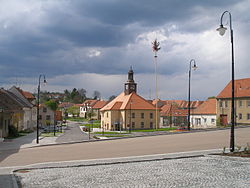 Town square with the town hall | |
 Flag  Coat of arms | |
 Bělčice Location in the Czech Republic | |
| Coordinates: 49°30′9″N 13°52′33″E / 49.50250°N 13.87583°ECoordinates: 49°30′9″N 13°52′33″E / 49.50250°N 13.87583°E | |
| Country | |
| Region | South Bohemian |
| District | Strakonice |
| First mentioned | 1243 |
| Area | |
| • Total | 34.33 km2 (13.25 sq mi) |
| Elevation | 526 m (1,726 ft) |
| Population (2021-01-01)[1] | |
| • Total | 983 |
| • Density | 29/km2 (74/sq mi) |
| Time zone | UTC+1 (CET) |
| • Summer (DST) | UTC+2 (CEST) |
| Postal code | 387 43 |
| Website | www |

Bělčice is a town in Strakonice District in the South Bohemian Region of the Czech Republic. It has about 1,000 inhabitants.
Bělčice lies approximately 28 kilometres (17 mi) north of Strakonice, 74 km (46 mi) north-west of České Budějovice, and 76 km (47 mi) south-west of Prague.
Administrative parts[]
Villages of Hostišovice, Podruhlí, Tisov, Újezdec, Záhrobí and Závišín are administrative parts of Bělčice.
References[]
| Wikimedia Commons has media related to Bělčice. |
| Authority control: National libraries |
|---|
This South Bohemian Region location article is a stub. You can help Wikipedia by . |
Categories:
- Cities and towns in the Czech Republic
- Populated places in Strakonice District
- South Bohemian Region geography stubs