Bagnols, Puy-de-Dôme
Bagnols | |
|---|---|
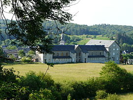 A general view of Bagnols | |
 Coat of arms | |
show Location of Bagnols | |
 Bagnols | |
| Coordinates: 45°30′04″N 2°37′59″E / 45.5011°N 2.6331°ECoordinates: 45°30′04″N 2°37′59″E / 45.5011°N 2.6331°E | |
| Country | France |
| Region | Auvergne-Rhône-Alpes |
| Department | Puy-de-Dôme |
| Arrondissement | Issoire |
| Canton | Le Sancy[1] |
| Intercommunality | Dômes Sancy Artense |
| Government | |
| • Mayor (2020–2026) | Alexandre Verdier[2] |
| Area 1 | 42.46 km2 (16.39 sq mi) |
| Population (Jan. 2018)[3] | 428 |
| • Density | 10/km2 (26/sq mi) |
| Time zone | UTC+01:00 (CET) |
| • Summer (DST) | UTC+02:00 (CEST) |
| INSEE/Postal code | 63028 /63810 |
| Elevation | 679–1,053 m (2,228–3,455 ft) (avg. 850 m or 2,790 ft) |
| Website | bagnols63.fr |
| 1 French Land Register data, which excludes lakes, ponds, glaciers > 1 km2 (0.386 sq mi or 247 acres) and river estuaries. | |


Bagnols is a commune in the Puy-de-Dôme department in Auvergne-Rhône-Alpes in central France.[4]
Population[]
| Year | Pop. | ±% |
|---|---|---|
| 1962 | 1,021 | — |
| 1968 | 1,038 | +1.7% |
| 1975 | 905 | −12.8% |
| 1982 | 891 | −1.5% |
| 1990 | 712 | −20.1% |
| 1999 | 532 | −25.3% |
| 2006 | 505 | −5.1% |
| 2011 | 492 | −2.6% |
| 2016 | 440 | −10.6% |
| Source: INSEE (1968–2016)[5] | ||
See also[]
References[]
- ^ "Décret 2014-210 du 21 février 2014 portant délimitation des cantons dans le département du Puy-de-Dôme" [2014-210 decree delimiting cantons of Puy-de-Dôme department]. Légifrance (in French). 21 February 2014. Retrieved 29 July 2016.
- ^ "Liste des Maires du Puy de Dôme" [List of Mayors of Puy-de-Dôme] (in French). Association of Rural Mayors of Puy-de-Dôme. Archived from the original on 24 September 2020. Retrieved 19 November 2020.
- ^ "Populations légales 2018". INSEE. 28 December 2020.
- ^ INSEE commune file (in French)
- ^ INSEE, 2006, 2011 and 2016 census (in French)
External links[]
- Town hall website (in French)
| Wikimedia Commons has media related to Bagnols (Puy-de-Dôme). |
This Puy-de-Dôme geographical article is a stub. You can help Wikipedia by . |
Categories:
- Communes of Puy-de-Dôme
- Puy-de-Dôme geography stubs