Manglieu
Manglieu | |
|---|---|
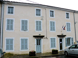 The town hall and school in Manglieu | |
show Location of Manglieu | |
 Manglieu | |
| Coordinates: 45°36′43″N 3°21′06″E / 45.6119°N 3.3517°ECoordinates: 45°36′43″N 3°21′06″E / 45.6119°N 3.3517°E | |
| Country | France |
| Region | Auvergne-Rhône-Alpes |
| Department | Puy-de-Dôme |
| Arrondissement | Clermont-Ferrand |
| Canton | Vic-le-Comte |
| Government | |
| • Mayor (2020–2026) | Michèle Brousse[1] |
| Area 1 | 21.09 km2 (8.14 sq mi) |
| Population (Jan. 2018)[2] | 466 |
| • Density | 22/km2 (57/sq mi) |
| Time zone | UTC+01:00 (CET) |
| • Summer (DST) | UTC+02:00 (CEST) |
| INSEE/Postal code | 63205 /63270 |
| Elevation | 399–646 m (1,309–2,119 ft) (avg. 430 m or 1,410 ft) |
| 1 French Land Register data, which excludes lakes, ponds, glaciers > 1 km2 (0.386 sq mi or 247 acres) and river estuaries. | |


Manglieu is a commune in the Puy-de-Dôme department in Auvergne in central France.
See also[]
References[]
- ^ "Répertoire national des élus: les maires". data.gouv.fr, Plateforme ouverte des données publiques françaises (in French). 2 December 2020. Retrieved 7 December 2020.
- ^ "Populations légales 2018". INSEE. 28 December 2020.
| Wikimedia Commons has media related to Manglieu. |
This Puy-de-Dôme geographical article is a stub. You can help Wikipedia by . |
Categories:
- Communes of Puy-de-Dôme
- Puy-de-Dôme geography stubs