Rochefort-Montagne
Rochefort-Montagne | |
|---|---|
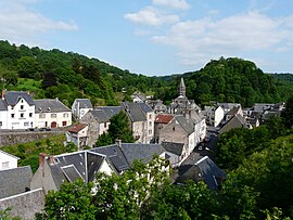 A general view of Rochefort-Montagne | |
 Coat of arms | |
show Location of Rochefort-Montagne | |
 Rochefort-Montagne | |
| Coordinates: 45°41′08″N 2°48′17″E / 45.6856°N 2.8047°ECoordinates: 45°41′08″N 2°48′17″E / 45.6856°N 2.8047°E | |
| Country | France |
| Region | Auvergne-Rhône-Alpes |
| Department | Puy-de-Dôme |
| Arrondissement | Issoire |
| Canton | Orcines |
| Intercommunality | |
| Government | |
| • Mayor (2020–2026) | Dominique Jarlier[1] |
| Area 1 | 17.45 km2 (6.74 sq mi) |
| Population (Jan. 2018)[2] | 863 |
| • Density | 49/km2 (130/sq mi) |
| Time zone | UTC+01:00 (CET) |
| • Summer (DST) | UTC+02:00 (CEST) |
| INSEE/Postal code | 63305 /63210 |
| Elevation | 771–1,280 m (2,530–4,199 ft) |
| 1 French Land Register data, which excludes lakes, ponds, glaciers > 1 km2 (0.386 sq mi or 247 acres) and river estuaries. | |


Rochefort-Montagne is a commune in the Puy-de-Dôme department in Auvergne in central France.
See also[]
References[]
- ^ "Répertoire national des élus: les maires". data.gouv.fr, Plateforme ouverte des données publiques françaises (in French). 2 December 2020.
- ^ "Populations légales 2018". INSEE. 28 December 2020.
| Wikimedia Commons has media related to Rochefort-Montagne. |
| show Authority control |
|---|
This Puy-de-Dôme geographical article is a stub. You can help Wikipedia by . |
Categories:
- Communes of Puy-de-Dôme
- Puy-de-Dôme geography stubs