Saint-Genès-Champespe
Saint-Genès-Champespe | |
|---|---|
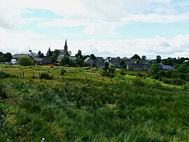 A general view of Saint-Genès-Champespe | |
 Coat of arms | |
show Location of Saint-Genès-Champespe | |
 Saint-Genès-Champespe | |
| Coordinates: 45°25′08″N 2°43′26″E / 45.419°N 2.724°ECoordinates: 45°25′08″N 2°43′26″E / 45.419°N 2.724°E | |
| Country | France |
| Region | Auvergne-Rhône-Alpes |
| Department | Puy-de-Dôme |
| Arrondissement | Issoire |
| Canton | Le Sancy |
| Intercommunality | Massif du Sancy |
| Government | |
| • Mayor (2020–2026) | Roland Perron[1] |
| Area 1 | 32.33 km2 (12.48 sq mi) |
| Population (Jan. 2018)[2] | 218 |
| • Density | 6.7/km2 (17/sq mi) |
| Time zone | UTC+01:00 (CET) |
| • Summer (DST) | UTC+02:00 (CEST) |
| INSEE/Postal code | 63346 /63850 |
| Elevation | 858–1,056 m (2,815–3,465 ft) (avg. 1,040 m or 3,410 ft) |
| 1 French Land Register data, which excludes lakes, ponds, glaciers > 1 km2 (0.386 sq mi or 247 acres) and river estuaries. | |


Saint-Genès-Champespe is a commune in the Puy-de-Dôme department in Auvergne in central France.
See also[]
References[]
- ^ "Liste des Maires du Puy de Dôme" [List of Mayors of Puy-de-Dôme] (in French). Association of Rural Mayors of Puy-de-Dôme. Retrieved 1 December 2020.
- ^ "Populations légales 2018". INSEE. 28 December 2020.
| Wikimedia Commons has media related to Saint-Genès-Champespe. |
This Puy-de-Dôme geographical article is a stub. You can help Wikipedia by . |
Categories:
- Communes of Puy-de-Dôme
- Puy-de-Dôme geography stubs