Vollore-Montagne
Vollore-Montagne | |
|---|---|
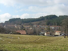 A general view of Vollore-Montagne | |
 Coat of arms | |
show Location of Vollore-Montagne | |
 Vollore-Montagne | |
| Coordinates: 45°47′09″N 3°40′28″E / 45.7858°N 3.6744°ECoordinates: 45°47′09″N 3°40′28″E / 45.7858°N 3.6744°E | |
| Country | France |
| Region | Auvergne-Rhône-Alpes |
| Department | Puy-de-Dôme |
| Arrondissement | Thiers |
| Canton | Thiers |
| Intercommunality | Thiers Dore et Montagne |
| Government | |
| • Mayor (2020–2026) | Jean-François Delaire[1] |
| Area 1 | 21.22 km2 (8.19 sq mi) |
| Population (Jan. 2018)[2] | 302 |
| • Density | 14/km2 (37/sq mi) |
| Time zone | UTC+01:00 (CET) |
| • Summer (DST) | UTC+02:00 (CEST) |
| INSEE/Postal code | 63468 /63120 |
| Elevation | 620–1,267 m (2,034–4,157 ft) |
| 1 French Land Register data, which excludes lakes, ponds, glaciers > 1 km2 (0.386 sq mi or 247 acres) and river estuaries. | |


Vollore-Montagne (French pronunciation: [vɔlɔʁ mɔ̃taɲ]; Occitan: Volora de Montanha) is a commune in the Puy-de-Dôme department in Auvergne in central France.
See also[]
References[]
- ^ "Répertoire national des élus: les maires". data.gouv.fr, Plateforme ouverte des données publiques françaises (in French). 2 December 2020.
- ^ "Populations légales 2018". INSEE. 28 December 2020.
| Wikimedia Commons has media related to Vollore-Montagne. |
This Puy-de-Dôme geographical article is a stub. You can help Wikipedia by . |
Categories:
- Communes of Puy-de-Dôme
- Puy-de-Dôme geography stubs