Le Broc, Puy-de-Dôme
Le Broc | |
|---|---|
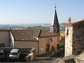 The town hall in Le Broc | |
 Coat of arms | |
show Location of Le Broc | |
 Le Broc | |
| Coordinates: 45°30′06″N 3°14′41″E / 45.5017°N 3.2447°ECoordinates: 45°30′06″N 3°14′41″E / 45.5017°N 3.2447°E | |
| Country | France |
| Region | Auvergne-Rhône-Alpes |
| Department | Puy-de-Dôme |
| Arrondissement | Issoire |
| Canton | Issoire |
| Intercommunality | Agglo Pays d'Issoire |
| Government | |
| • Mayor (2020–2026) | Olivier Tezenas |
| Area 1 | 17.45 km2 (6.74 sq mi) |
| Population (Jan. 2018)[1] | 695 |
| • Density | 40/km2 (100/sq mi) |
| Time zone | UTC+01:00 (CET) |
| • Summer (DST) | UTC+02:00 (CEST) |
| INSEE/Postal code | 63054 /63500 |
| Elevation | 376–567 m (1,234–1,860 ft) (avg. 470 m or 1,540 ft) |
| 1 French Land Register data, which excludes lakes, ponds, glaciers > 1 km2 (0.386 sq mi or 247 acres) and river estuaries. | |


Le Broc (French pronunciation: [lə bʁɔk]) is a commune in the Puy-de-Dôme department in Auvergne-Rhône-Alpes in central France.
Population[]
| Year | Pop. | ±% p.a. |
|---|---|---|
| 1968 | 572 | — |
| 1975 | 536 | −0.92% |
| 1982 | 562 | +0.68% |
| 1990 | 588 | +0.57% |
| 1999 | 591 | +0.06% |
| 2007 | 610 | +0.40% |
| 2012 | 640 | +0.96% |
| 2017 | 679 | +1.19% |
| Source: INSEE[2] | ||
See also[]
References[]
- ^ "Populations légales 2018". INSEE. 28 December 2020.
- ^ Population en historique depuis 1968, INSEE
| Wikimedia Commons has media related to Le Broc (Puy-de-Dôme). |
| show Authority control |
|---|
This Puy-de-Dôme geographical article is a stub. You can help Wikipedia by . |
Categories:
- Communes of Puy-de-Dôme
- Puy-de-Dôme geography stubs