Perrier, Puy-de-Dôme
Perrier | |
|---|---|
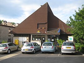 The town hall in Perrier | |
show Location of Perrier | |
 Perrier | |
| Coordinates: 45°32′44″N 3°12′08″E / 45.5456°N 3.2022°ECoordinates: 45°32′44″N 3°12′08″E / 45.5456°N 3.2022°E | |
| Country | France |
| Region | Auvergne-Rhône-Alpes |
| Department | Puy-de-Dôme |
| Arrondissement | Issoire |
| Canton | Issoire |
| Intercommunality | Agglo Pays d'Issoire |
| Government | |
| • Mayor (2020–2026) | Bernard Roux |
| Area 1 | 6.37 km2 (2.46 sq mi) |
| Population (Jan. 2018)[1] | 889 |
| • Density | 140/km2 (360/sq mi) |
| Time zone | UTC+01:00 (CET) |
| • Summer (DST) | UTC+02:00 (CEST) |
| INSEE/Postal code | 63275 /63500 |
| Elevation | 410–601 m (1,345–1,972 ft) (avg. 430 m or 1,410 ft) |
| 1 French Land Register data, which excludes lakes, ponds, glaciers > 1 km2 (0.386 sq mi or 247 acres) and river estuaries. | |


Perrier (French pronunciation: [pɛʁje]) is a commune in the Puy-de-Dôme department in Auvergne in central France.
See also[]
References[]
- ^ "Populations légales 2018". INSEE. 28 December 2020.
| Wikimedia Commons has media related to Perrier. |
This Puy-de-Dôme geographical article is a stub. You can help Wikipedia by . |
Categories:
- Communes of Puy-de-Dôme
- Puy-de-Dôme geography stubs