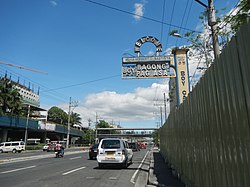
Bagong Pag-asa
This article needs additional citations for verification. (November 2013) |
Bagong Pag-asa
Magsaysay District | |
|---|---|
Barangay | |
 | |
 Map of Quezon City showing Bagong Pag-asa | |
 Bagong Pag-asa Location of Bagong Pag-asa within Metro Manila | |
| Coordinates: 14°39′44″N 121°1′59″E / 14.66222°N 121.03306°ECoordinates: 14°39′44″N 121°1′59″E / 14.66222°N 121.03306°E | |
| Country | Philippines |
| Region | National Capital Region |
| City | Quezon City |
| District | 1st District of Quezon City |
| Established | April 7, 1970[1] |
| Government | |
| • Type | Barangay |
| • Barangay Chairman | Rodolfo S. Palma[2] |
| Population (2020)[3] | |
| • Total | 29,389 |
| Time zone | UTC+8 (PST) |
| Zip Code | 1105 |
| Area code(s) | 2 |
| PSGC | 137404009 |
| Website | |

Bagong Pag-asa, also known as the Magsaysay District, is an administrative division in eastern Metro Manila. It is an urban barangay of Quezon City with low-density housing and is known for its shopping malls, transport hubs and office buildings.
Neighboring barangays include Project 6 and Vasra in the northeast; Bahay Toro in the north; Pinyahan in the east; Veterans Village, Bungad and Sto. Cristo in the northwest; Phil-Am in the west; West Triangle in the southwest; and South Triangle in the south.
History[]
The land that is now occupied by the barangay was a cogon grassland with rice paddies, bamboo groves, and fruit-bearing trees that were said to be part of the Diliman Estate, a 1,600 ha (16 km2) property owned by the Tuazon family that was sold to the Philippine government in 1938, which was included in the newly-founded Quezon City in 1939.[4][5]
New housing development[]
In 1954, the Social Welfare Administration (now the Department of Social Welfare and Development), offered informal settlers from Barrio Tatalon (now Barangay Tatalon) in Quezon City an opportunity for permanent residential housing in a new residential development north of the area. Some settlers did not move into the new development, and relocated instead to the areas around the University of the Philippines Diliman campus and other places in the city, while others moved to the Malate district of the City of Manila.[5]
As army engineers, the Phlippine Homesite and Housing Corporation, and other government entities implemented the relocation and settlement of the informal settlers, the development was named the Magsaysay District. It eventually became known as Bagong Pag-asa, which is Filipino for "a new hope" as a way for its early residents to signify the hope for a better life. It was said to have originated from a speech of then-President Ramon Magsaysay, who was also responsible for the relocation program itself, as he was quoted for saying, "there is new hope" for the Philippines.[5]
Barangay established[]
The residential development was incorporated as a barrio through Quezon City Ordinance No. 4386 series of 1960, which was approved on April 7, 1960 by Vice Mayor Vicente O. Novales. There was a lack of basic utilities at the time, resulting in drinking water having to be rationed by the city fire department, and its early pioneers had to walk through unpaved road to reach city transportation networks.[5]
Barrio Bagong Pag-asa was later recognized as a barangay on June 25, 1975 through Executive Order No. 24 by then-Mayor Norberto S. Amoranto, which converted existing barrios into barangays. Its first barangay elections were held that same year.[5]
Landmarks[]
Triangle Park (North Triangle) corridor[]
TriNoma along with the entire Vertis North development of Ayala Malls, the Ninoy Aquino Parks and Wildlife Center and the PAGASA Garden are all found inside the Triangle Park.
Other notable landmarks[]
The SM City North EDSA complex is predominantly located within the barangay, excluding The Annex which is under the jurisdiction of Barangay Sto. Cristo. It will be further expanded in size once the five Business Process Outsourcing and hotel towers are completed, replacing the former site of the Super Sale Club.
Bagong Lipunan Pag-asa Condominiums, an Urban Bliss site and Golden Acres (Home for the Aged), projects of former First Lady Imelda Romualdez-Marcos during her husband's presidency are both located behind the SM City North EDSA complex.
Future development[]
Upon the completion of the Unified Grand Central Station, it will connect the existing stations of the LRT Line 1 and MRT Line 3 to the soon-to-be-completed MRT Line 7 and the planned Metro Manila Subway.
Barangay and Sangguniang Kabataan officials[]
Members of Sangguniang Barangay[]
| Title | Name |
|---|---|
| Barangay Captain Punong Barangay |
Rodolfo S. Palma[6] |
| SK Chairperson Sangguniang Kabataan |
Christian Paul M. Mabini |
| Secretary Kalihim |
Alberto D. Doloiras |
| Treasurer Ingat Yaman |
|
| Barangay councilors Kagawad |
Josefina A. Ronquillo |
| Rene J. Sumacot | |
| Franze Russele B. Seriosa | |
| Dino Aldo D. Fortuno | |
| Michael S. Canceran | |
| Danilo T. Benzon | |
| Edgardo D. Madrigal |
The new Barangay and SK Councils were elected on May 14, 2018.
Government[]
The seat of government of Bagong Pag-asa is located at the intersection of Road 9 and Road 11.[2]
Demography[]
Barangay Bagong Pag-asa is the 27th most-populated barangay in Quezon City, with a population of 29,389 according to the 2020 census,[3] up from a population of 32,267 in the 2015 census.[7]
See also[]
References[]
- ^ "QC : Barangay Profiles". Quezon City Public Library. Archived from the original on 2013-03-14. Retrieved 2021-11-12.
- ^ a b "Quezon City Barangay Officials". Quezon City Government. Retrieved 2021-11-12.
- ^ a b "2020 Census of Population and Housing (2020 CPH) Population Counts Declared Official by the President". Philippine Statistics Authority. July 7, 2021. Retrieved November 6, 2021.
- ^ "Statement: President Quezon on Purchase of the Diliman Estate and another hacienda, October 8, 1938 GOVPH". Official Gazette of the Republic of the Philippines. Retrieved 2021-11-12.
- ^ a b c d e History of QC Barangays: Journey to Early Beginnings of Quezon City Barangays. 1. Quezon City: Quezon City Public Library. 2019.
- ^ "Barangay Officials". Quezon City Government. Retrieved August 25, 2020.
- ^ "psa.gov.ph/content/population-national-capital-region-based-2015-census-population-0". psa.gov.ph. Retrieved 2018-07-12.
| ||
| Topics |  | |
| Government | ||
| Barangays |
| |
| Mixed-use developments | ||
| Special Development Zone | ||
| Congressional Districts | ||
| See also | Frost Plan | |
| ||
- Quezon City
- Barangays of Quezon City
- Barangays of Metro Manila