Châteaufort, Yvelines
Châteaufort | |
|---|---|
 Town hall | |
 Coat of arms | |
show Location of Châteaufort | |
 Châteaufort | |
| Coordinates: 48°43′56″N 2°05′32″E / 48.7322°N 2.0922°ECoordinates: 48°43′56″N 2°05′32″E / 48.7322°N 2.0922°E | |
| Country | France |
| Region | Île-de-France |
| Department | Yvelines |
| Arrondissement | Versailles |
| Canton | Maurepas |
| Intercommunality | CA Versailles Grand Parc |
| Government | |
| • Mayor (2020–2026) | Patrice Berquet[1] |
| Area 1 | 4.88 km2 (1.88 sq mi) |
| Population (Jan. 2018)[2] | 1,408 |
| • Density | 290/km2 (750/sq mi) |
| Time zone | UTC+01:00 (CET) |
| • Summer (DST) | UTC+02:00 (CEST) |
| INSEE/Postal code | 78143 /78117 |
| Elevation | 86–164 m (282–538 ft) (avg. 150 m or 490 ft) |
| 1 French Land Register data, which excludes lakes, ponds, glaciers > 1 km2 (0.386 sq mi or 247 acres) and river estuaries. | |


Châteaufort (French pronunciation: [ʃɑtofɔʁ]) is a commune in the Yvelines department in the Île-de-France in north-central France. It is located 9 km (5.6 mi) south of Versailles, and 27 km (17 mi) southwest of Paris.
Châteaufort inhabitants are named Castelfortain.
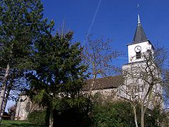
Saint-Christophe
The commune is named after the existence of three fortified castles during the Middle Ages; indeed, château fort means "fortified castle" in French.
On August 19, 1913, ahead of the Châteaufort aerodrome, the French aviator Adolphe Pégoud became the first man to jump from a plane using a parachute. The jump was made from a Blériot plane 200 m above the ground.
See also[]
- Communes of the Yvelines department
References[]
- ^ "Répertoire national des élus: les maires". data.gouv.fr, Plateforme ouverte des données publiques françaises (in French). 2 December 2020. Retrieved 7 December 2020.
- ^ "Populations légales 2018". INSEE. 28 December 2020.
| Wikimedia Commons has media related to Châteaufort, Yvelines. |
| show Communes of the Yvelines department |
|---|
| show Authority control |
|---|
This Yvelines geographical article is a stub. You can help Wikipedia by . |
Categories:
- Communes of Yvelines
- Yvelines geography stubs