Méré, Yvelines
Méré | |
|---|---|
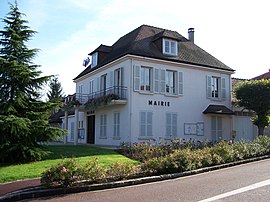 Town hall | |
 Coat of arms | |
show Location of Méré | |
 Méré | |
| Coordinates: 48°47′13″N 1°49′06″E / 48.7869°N 1.8183°ECoordinates: 48°47′13″N 1°49′06″E / 48.7869°N 1.8183°E | |
| Country | France |
| Region | Île-de-France |
| Department | Yvelines |
| Arrondissement | Rambouillet |
| Canton | Aubergenville |
| Government | |
| • Mayor (2020–2026) | Michel Recoussines |
| Area 1 | 10.32 km2 (3.98 sq mi) |
| Population (Jan. 2018)[1] | 1,673 |
| • Density | 160/km2 (420/sq mi) |
| Time zone | UTC+01:00 (CET) |
| • Summer (DST) | UTC+02:00 (CEST) |
| INSEE/Postal code | 78389 /78490 |
| Elevation | 65–184 m (213–604 ft) (avg. 150 m or 490 ft) |
| 1 French Land Register data, which excludes lakes, ponds, glaciers > 1 km2 (0.386 sq mi or 247 acres) and river estuaries. | |


Méré is a commune in the Yvelines department in the Île-de-France region in north-central France. François Quesnay a Physiocrat and one of the first to attempt to establish a rational science of economics, was born in Méré.
See also[]
- Communes of the Yvelines department
References[]
- ^ "Populations légales 2018". INSEE. 28 December 2020.
| Wikimedia Commons has media related to Méré (Yvelines). |
| show Communes of the Yvelines department |
|---|
| show Authority control |
|---|
This Yvelines geographical article is a stub. You can help Wikipedia by . |
Categories:
- Communes of Yvelines
- Yvelines geography stubs