Chavenay
Chavenay | |
|---|---|
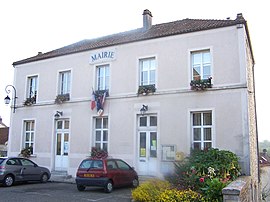 The town hall in Chavenay | |
 Coat of arms | |
show Location of Chavenay | |
 Chavenay | |
| Coordinates: 48°51′16″N 1°59′14″E / 48.8544°N 1.9872°ECoordinates: 48°51′16″N 1°59′14″E / 48.8544°N 1.9872°E | |
| Country | France |
| Region | Île-de-France |
| Department | Yvelines |
| Arrondissement | Saint-Germain-en-Laye |
| Canton | Saint-Cyr-l'École |
| Government | |
| • Mayor (2020–2026) | Myriam Brenac[1] |
| Area 1 | 6.03 km2 (2.33 sq mi) |
| Population (Jan. 2018)[2] | 1,791 |
| • Density | 300/km2 (770/sq mi) |
| Time zone | UTC+01:00 (CET) |
| • Summer (DST) | UTC+02:00 (CEST) |
| INSEE/Postal code | 78152 /78450 |
| Elevation | 71–129 m (233–423 ft) (avg. 100 m or 330 ft) |
| 1 French Land Register data, which excludes lakes, ponds, glaciers > 1 km2 (0.386 sq mi or 247 acres) and river estuaries. | |


Chavenay, also known as Vallon de Chavenay, is a commune in the Yvelines department in the Île-de-France region in north-central France. It is located close to Saint-Nom-la-Bretèche, Saint-Germain-en-Laye, and Versailles.

Chavenay church
Twin towns[]
Along with Crespières, Feucherolles and Saint-Nom-la-Bretèche Chavenay is twinned with Rösrath, Germany.
See also[]
- Communes of the Yvelines department
References[]
- ^ "Répertoire national des élus: les maires". data.gouv.fr, Plateforme ouverte des données publiques françaises (in French). 2 December 2020. Retrieved 7 December 2020.
- ^ "Populations légales 2018". INSEE. 28 December 2020.
| Wikimedia Commons has media related to Chavenay. |
| show Communes of the Yvelines department |
|---|
This Yvelines geographical article is a stub. You can help Wikipedia by . |
Categories:
- Communes of Yvelines
- Yvelines geography stubs