Saint-Léger-en-Yvelines
Saint-Léger-en-Yvelines | |
|---|---|
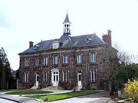 Town hall | |
show Location of Saint-Léger-en-Yvelines | |
 Saint-Léger-en-Yvelines | |
| Coordinates: 48°43′20″N 1°45′59″E / 48.7222°N 1.7664°ECoordinates: 48°43′20″N 1°45′59″E / 48.7222°N 1.7664°E | |
| Country | France |
| Region | Île-de-France |
| Department | Yvelines |
| Arrondissement | Rambouillet |
| Canton | Rambouillet |
| Government | |
| • Mayor (2020–2026) | Jean-Pierre Ghibaudo[1] |
| Area 1 | 34.52 km2 (13.33 sq mi) |
| Population (Jan. 2018)[2] | 1,385 |
| • Density | 40/km2 (100/sq mi) |
| Time zone | UTC+01:00 (CET) |
| • Summer (DST) | UTC+02:00 (CEST) |
| INSEE/Postal code | 78562 /78610 |
| Elevation | 112–186 m (367–610 ft) (avg. 150 m or 490 ft) |
| 1 French Land Register data, which excludes lakes, ponds, glaciers > 1 km2 (0.386 sq mi or 247 acres) and river estuaries. | |


Saint-Léger-en-Yvelines (French pronunciation: [sɛ̃ leʒe ɑ̃.n‿ivlin] (![]() listen)) is a commune in the Yvelines department in the Île-de-France in north-central France.
listen)) is a commune in the Yvelines department in the Île-de-France in north-central France.
Geography[]
The commune of Saint-Léger-en-Yvelines is in the centre of the department and in the heart of the Forest of Rambouillet. Rambouillet itself, the administrative centre of the arrondissement, is some 11 km (6.8 mi) to the south-east, and the prefecture, Versailles, is 37 km (23 mi) to the north-east.
The commune is a rural one, and 94% of the unbuilt area is covered by forest, complemented by some cultivated clearings, primarily to the south of the village.
See also[]
- Communes of the Yvelines department
References[]
- ^ "Répertoire national des élus: les maires". data.gouv.fr, Plateforme ouverte des données publiques françaises (in French). 2 December 2020. Retrieved 7 December 2020.
- ^ "Populations légales 2018". INSEE. 28 December 2020.
| Wikimedia Commons has media related to Saint-Léger-en-Yvelines. |
| show Communes of the Yvelines department |
|---|
| show Authority control |
|---|
This Yvelines geographical article is a stub. You can help Wikipedia by . |
Categories:
- Communes of Yvelines
- Yvelines geography stubs