Flexanville
Flexanville | |
|---|---|
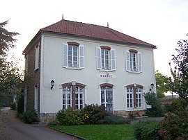 Town hall | |
show Location of Flexanville | |
 Flexanville | |
| Coordinates: 48°51′17″N 1°44′19″E / 48.8547°N 1.7386°ECoordinates: 48°51′17″N 1°44′19″E / 48.8547°N 1.7386°E | |
| Country | France |
| Region | Île-de-France |
| Department | Yvelines |
| Arrondissement | Rambouillet |
| Canton | Aubergenville |
| Government | |
| • Mayor (2020–2026) | Didier Saussay[1] |
| Area 1 | 8.89 km2 (3.43 sq mi) |
| Population (Jan. 2018)[2] | 589 |
| • Density | 66/km2 (170/sq mi) |
| Time zone | UTC+01:00 (CET) |
| • Summer (DST) | UTC+02:00 (CEST) |
| INSEE/Postal code | 78236 /78910 |
| Elevation | 95–140 m (312–459 ft) (avg. 121 m or 397 ft) |
| 1 French Land Register data, which excludes lakes, ponds, glaciers > 1 km2 (0.386 sq mi or 247 acres) and river estuaries. | |


Flexanville is a commune in the Yvelines department in the Île-de-France region of north-central France.
River[]
The commune shares its name with a small river that passes through it, la Flexanville. This waterway flows through eight other communes for a total distance of 11.1 kilometres (6.9 mi). The Flexanville is a tributary of the Vaucouleurs which in turn empties into the Seine.[3]
Views[]
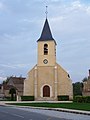
Local church

See also[]
- Communes of the Yvelines department
References[]
- ^ "Répertoire national des élus: les maires". data.gouv.fr, Plateforme ouverte des données publiques françaises (in French). 2 December 2020. Retrieved 7 December 2020.
- ^ "Populations légales 2018". INSEE. 28 December 2020.
- ^ Sandre. "Fiche cours d'eau - La Flexanville (H3074000 )".
| Wikimedia Commons has media related to Flexanville. |
| show Communes of the Yvelines department |
|---|
This Yvelines geographical article is a stub. You can help Wikipedia by . |
Categories:
- Communes of Yvelines
- Yvelines geography stubs