Charqueadas
Charqueadas | |
|---|---|
 Flag  Coat of arms | |
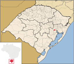 Location within Rio Grande do Sul | |
 Charqueadas Location in Brazil | |
| Coordinates: 29°58′S 51°38′W / 29.967°S 51.633°WCoordinates: 29°58′S 51°38′W / 29.967°S 51.633°W | |
| Country | |
| State | Rio Grande do Sul |
| Population (2020[1]) | |
| • Total | 41,258 |
| Time zone | UTC-3 (BRT) |
| • Summer (DST) | UTC-2 (BRST) |

Charqueadas is a municipality in the state of Rio Grande do Sul, Brazil. It is located on the southern side of the Jacuí River, in the eastern-central part of the state. The city is 57 km (35 mi) west of the state capital and most populous city, Porto Alegre, and belongs to its metropolitan area. The area of the municipality is 214.80 km2 (82.93 sq mi), and it have a population of 41,258 (2020 estimate, IBGE), making it the largest municipality by population in the region. It borders to the south Arroio dos Ratos, to the north Triunfo, to the east Eldorado do Sul and to the west São Jerônimo.
See also[]
- List of municipalities in Rio Grande do Sul
References[]
| show |
|---|

| show Authority control |
|---|
 | This geographical article relating to Rio Grande do Sul is a stub. You can help Wikipedia by . |
Categories:
- Municipalities in Rio Grande do Sul
- Rio Grande do Sul geography stubs