Chaumontel
Chaumontel | |
|---|---|
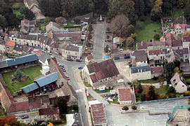 An aerial view of the area around the church in Chaumontel | |
show Location of Chaumontel | |
 Chaumontel | |
| Coordinates: 49°07′39″N 2°25′47″E / 49.1275°N 2.4297°ECoordinates: 49°07′39″N 2°25′47″E / 49.1275°N 2.4297°E | |
| Country | France |
| Region | Île-de-France |
| Department | Val-d'Oise |
| Arrondissement | Sarcelles |
| Canton | Fosses |
| Government | |
| • Mayor (2020–2026) | Sylvain Saragosa[1] |
| Area 1 | 4.23 km2 (1.63 sq mi) |
| Population (Jan. 2018)[2] | 3,251 |
| • Density | 770/km2 (2,000/sq mi) |
| Time zone | UTC+01:00 (CET) |
| • Summer (DST) | UTC+02:00 (CEST) |
| INSEE/Postal code | 95149 /95270 |
| 1 French Land Register data, which excludes lakes, ponds, glaciers > 1 km2 (0.386 sq mi or 247 acres) and river estuaries. | |


Chaumontel (French pronunciation: [ʃomɔ̃tɛl] (![]() listen)) is a commune in the Val-d'Oise department in Île-de-France in northern France.
listen)) is a commune in the Val-d'Oise department in Île-de-France in northern France.
See also[]
References[]
- ^ "Répertoire national des élus: les maires". data.gouv.fr, Plateforme ouverte des données publiques françaises (in French). 2 December 2020. Retrieved 7 December 2020.
- ^ "Populations légales 2018". INSEE. 28 December 2020.
External links[]
| Wikimedia Commons has media related to Chaumontel. |
- Official website (in French)
- Association of Mayors of the Val d’Oise Archived 2008-04-07 at the Wayback Machine (in French)
This Val-d'Oise geographical article is a stub. You can help Wikipedia by . |
Categories:
- Communes of Val-d'Oise
- Val-d'Oise geography stubs