Montlignon
Montlignon | |
|---|---|
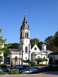 The church of Saint-André, in Montlignon | |
 Coat of arms | |
show Location of Montlignon | |
 Montlignon | |
| Coordinates: 49°00′37″N 2°17′05″E / 49.0103°N 2.2847°ECoordinates: 49°00′37″N 2°17′05″E / 49.0103°N 2.2847°E | |
| Country | France |
| Region | Île-de-France |
| Department | Val-d'Oise |
| Arrondissement | Sarcelles |
| Canton | Montmorency |
| Intercommunality | CA Plaine Vallée |
| Government | |
| • Mayor (2020–2026) | Alain Goujon[1] |
| Area 1 | 2.84 km2 (1.10 sq mi) |
| Population (Jan. 2018)[2] | 2,963 |
| • Density | 1,000/km2 (2,700/sq mi) |
| Time zone | UTC+01:00 (CET) |
| • Summer (DST) | UTC+02:00 (CEST) |
| INSEE/Postal code | 95426 /95680 |
| Elevation | 62–185 m (203–607 ft) |
| 1 French Land Register data, which excludes lakes, ponds, glaciers > 1 km2 (0.386 sq mi or 247 acres) and river estuaries. | |


Montlignon (French pronunciation: [mɔ̃liɲɔ̃] (![]() listen)) is a commune in the Val-d'Oise department in Île-de-France in northern France.
listen)) is a commune in the Val-d'Oise department in Île-de-France in northern France.
See also[]
References[]
- ^ "Répertoire national des élus: les maires". data.gouv.fr, Plateforme ouverte des données publiques françaises (in French). 2 December 2020. Retrieved 7 December 2020.
- ^ "Populations légales 2018". INSEE. 28 December 2020.
External links[]
- Base Mérimée: Search for heritage in the commune, Ministère français de la Culture. (in French)
- Association of Mayors of the Val d’Oise (in French)
| Wikimedia Commons has media related to Montlignon. |
This Val-d'Oise geographical article is a stub. You can help Wikipedia by . |
Categories:
- Communes of Val-d'Oise
- Val-d'Oise geography stubs