Pierrelaye
Pierrelaye | |
|---|---|
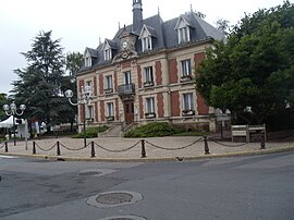 The town hall of Pierrelaye | |
show Location of Pierrelaye | |
 Pierrelaye | |
| Coordinates: 49°01′24″N 2°09′03″E / 49.0233°N 2.1508°ECoordinates: 49°01′24″N 2°09′03″E / 49.0233°N 2.1508°E | |
| Country | France |
| Region | Île-de-France |
| Department | Val-d'Oise |
| Arrondissement | Argenteuil |
| Canton | Taverny |
| Intercommunality | CA Val Parisis |
| Government | |
| • Mayor (2020–2026) | Michel Vallade |
| Area 1 | 9.21 km2 (3.56 sq mi) |
| Population (Jan. 2018)[1] | 8,908 |
| • Density | 970/km2 (2,500/sq mi) |
| Time zone | UTC+01:00 (CET) |
| • Summer (DST) | UTC+02:00 (CEST) |
| INSEE/Postal code | 95488 /95480 |
| Elevation | 35–78 m (115–256 ft) |
| 1 French Land Register data, which excludes lakes, ponds, glaciers > 1 km2 (0.386 sq mi or 247 acres) and river estuaries. | |


Pierrelaye (French pronunciation: [pjɛʁlɛ] (![]() listen)) is a commune in the Val-d'Oise department in Île-de-France in northern France.
listen)) is a commune in the Val-d'Oise department in Île-de-France in northern France.
See also[]
- Communes of the Val-d'Oise department
- Gare de Pierrelaye
References[]
- ^ "Populations légales 2018". INSEE. 28 December 2020.
External links[]
- Association of Mayors of the Val d’Oise (in French)
| Wikimedia Commons has media related to Pierrelaye. |
| show Authority control |
|---|
This Val-d'Oise geographical article is a stub. You can help Wikipedia by . |
Categories:
- Communes of Val-d'Oise
- Val-d'Oise geography stubs