Hédouville
Hédouville | |
|---|---|
 The road entering the village of Hédouville | |
 Coat of arms | |
show Location of Hédouville | |
 Hédouville | |
| Coordinates: 49°09′16″N 2°10′15″E / 49.1544°N 2.1708°ECoordinates: 49°09′16″N 2°10′15″E / 49.1544°N 2.1708°E | |
| Country | France |
| Region | Île-de-France |
| Department | Val-d'Oise |
| Arrondissement | Pontoise |
| Canton | Saint-Ouen-l'Aumône |
| Intercommunality | CC Sausseron Impressionnistes |
| Government | |
| • Mayor (2020–2026) | Eric Couppe[1] |
| Area 1 | 5.28 km2 (2.04 sq mi) |
| Population (Jan. 2018)[2] | 282 |
| • Density | 53/km2 (140/sq mi) |
| Time zone | UTC+01:00 (CET) |
| • Summer (DST) | UTC+02:00 (CEST) |
| INSEE/Postal code | 95304 /95690 |
| Elevation | 41–182 m (135–597 ft) |
| 1 French Land Register data, which excludes lakes, ponds, glaciers > 1 km2 (0.386 sq mi or 247 acres) and river estuaries. | |


Hédouville is a commune in the Val-d'Oise department in Île-de-France in northern France.
Geography[]
Hédouville is located just inside Île-de-France, on its border with Picardy. The town is part of the Parc Naturel Régional du Véxin Français.
Toponymy[]
The town name has German origins from Haidulf (name) and Latin villa (domain). Hédouville is therefore interpreted as "Domain of Haidulf".
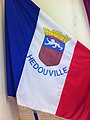
A flag with the coat of arms of Hédouville

A view of the church of Hédouville

The washing place
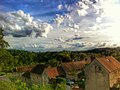
Looking south-west in the village


See also[]
References[]
- ^ "Répertoire national des élus: les maires". data.gouv.fr, Plateforme ouverte des données publiques françaises (in French). 2 December 2020. Retrieved 7 December 2020.
- ^ "Populations légales 2018". INSEE. 28 December 2020.
External links[]
| Wikimedia Commons has media related to Hédouville. |
- Base Mérimée: Search for heritage in the commune, Ministère français de la Culture. (in French)
- Association of Mayors of the Val d’Oise (in French)
| show Authority control |
|---|
This Val-d'Oise geographical article is a stub. You can help Wikipedia by . |
Categories:
- Communes of Val-d'Oise
- Val-d'Oise geography stubs