Wy-dit-Joli-Village
Wy-dit-Joli-Village | |
|---|---|
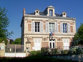 The town hall of Wy-dit-Joli-Village | |
 Coat of arms | |
show Location of Wy-dit-Joli-Village | |
 Wy-dit-Joli-Village | |
| Coordinates: 49°06′11″N 1°50′09″E / 49.1031°N 1.8358°ECoordinates: 49°06′11″N 1°50′09″E / 49.1031°N 1.8358°E | |
| Country | France |
| Region | Île-de-France |
| Department | Val-d'Oise |
| Arrondissement | Pontoise |
| Canton | Vauréal |
| Intercommunality | |
| Government | |
| • Mayor (2020–2026) | Laurent Bossu[1] |
| Area 1 | 8.37 km2 (3.23 sq mi) |
| Population (Jan. 2018)[2] | 332 |
| • Density | 40/km2 (100/sq mi) |
| Time zone | UTC+01:00 (CET) |
| • Summer (DST) | UTC+02:00 (CEST) |
| INSEE/Postal code | 95690 /95420 |
| Elevation | 99–199 m (325–653 ft) (avg. 115 m or 377 ft) |
| 1 French Land Register data, which excludes lakes, ponds, glaciers > 1 km2 (0.386 sq mi or 247 acres) and river estuaries. | |


Wy-dit-Joli-Village is a commune in the Val-d'Oise department and Île-de-France region of France.
Name[]
The name Wy comes from the Latin vicus – meaning "village" or cluster of houses (as opposed to a villa, an isolated farm and master's residence).
The full name Wy-dit-Joli-Village ("Wy-called-Pretty-Village") is said to have arisen from an incident in which King Henry IV of France, hunting in the area and enquiring what the settlement was called, exclaimed Ah! Quel joli village! : "Oh, what a pretty village!"
Population[]
| Year | Pop. | ±% |
|---|---|---|
| 2006 | 329 | — |
| 2007 | 335 | +1.8% |
| 2008 | 340 | +1.5% |
| 2009 | 332 | −2.4% |
| 2010 | 327 | −1.5% |
| 2011 | 322 | −1.5% |
| 2012 | 316 | −1.9% |
| 2013 | 309 | −2.2% |
| 2014 | 318 | +2.9% |
| 2015 | 326 | +2.5% |
| 2016 | 335 | +2.8% |
See also[]
References[]
- ^ "Répertoire national des élus: les maires". data.gouv.fr, Plateforme ouverte des données publiques françaises (in French). 2 December 2020. Retrieved 7 December 2020.
- ^ "Populations légales 2018". INSEE. 28 December 2020.
External links[]
- Base Mérimée: Search for heritage in the commune, Ministère français de la Culture. (in French)
- Association of Mayors of the Val d’Oise (in French)
| Wikimedia Commons has media related to Wy-dit-Joli-Village. |
| show Authority control |
|---|
This Val-d'Oise geographical article is a stub. You can help Wikipedia by . |
Categories:
- Communes of Val-d'Oise
- Val-d'Oise geography stubs