Hodent
Hodent | |
|---|---|
 The chapel of Sainte-Marguerite, in Hodent | |
 Coat of arms | |
show Location of Hodent | |
 Hodent | |
| Coordinates: 49°08′41″N 1°46′05″E / 49.1447°N 1.7681°ECoordinates: 49°08′41″N 1°46′05″E / 49.1447°N 1.7681°E | |
| Country | France |
| Region | Île-de-France |
| Department | Val-d'Oise |
| Arrondissement | Pontoise |
| Canton | Vauréal |
| Government | |
| • Mayor (2020–2026) | Éric Breton[1] |
| Area 1 | 4.37 km2 (1.69 sq mi) |
| Population (Jan. 2018)[2] | 210 |
| • Density | 48/km2 (120/sq mi) |
| Time zone | UTC+01:00 (CET) |
| • Summer (DST) | UTC+02:00 (CEST) |
| INSEE/Postal code | 95309 /95420 |
| Elevation | 49–140 m (161–459 ft) |
| 1 French Land Register data, which excludes lakes, ponds, glaciers > 1 km2 (0.386 sq mi or 247 acres) and river estuaries. | |


Hodent is a commune in the Val-d'Oise department and Île-de-France region of France. It is located in the .
Geography[]
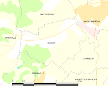
A map of the commune
Hodent is located approximately 53 km from Paris.
Notable people[]
See also[]
References[]
- ^ "Répertoire national des élus: les maires". data.gouv.fr, Plateforme ouverte des données publiques françaises (in French). 2 December 2020. Retrieved 7 December 2020.
- ^ "Populations légales 2018". INSEE. 28 December 2020.
External links[]
| Wikimedia Commons has media related to Hodent. |
- Base Mérimée: Search for heritage in the commune, Ministère français de la Culture. (in French)
- Association of Mayors of the Val d’Oise (in French)
This Val-d'Oise geographical article is a stub. You can help Wikipedia by . |
Categories:
- Communes of Val-d'Oise
- Val-d'Oise geography stubs