Courzieu
Courzieu | |
|---|---|
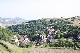 The church and surrounding buildings in Courzieu | |
show Location of Courzieu | |
 Courzieu | |
| Coordinates: 45°44′37″N 4°34′18″E / 45.7436°N 4.5717°ECoordinates: 45°44′37″N 4°34′18″E / 45.7436°N 4.5717°E | |
| Country | France |
| Region | Auvergne-Rhône-Alpes |
| Department | Rhône |
| Arrondissement | Villefranche-sur-Saône |
| Canton | L'Arbresle |
| Intercommunality | CC du Pays de l'Arbresle |
| Government | |
| • Mayor (2020–2026) | Jean-Bernard Cherblanc |
| Area 1 | 27 km2 (10 sq mi) |
| Population (Jan. 2018)[1] | 1,142 |
| • Density | 42/km2 (110/sq mi) |
| Time zone | UTC+01:00 (CET) |
| • Summer (DST) | UTC+02:00 (CEST) |
| INSEE/Postal code | 69067 /69690 |
| Elevation | 269–908 m (883–2,979 ft) (avg. 600 m or 2,000 ft) |
| 1 French Land Register data, which excludes lakes, ponds, glaciers > 1 km2 (0.386 sq mi or 247 acres) and river estuaries. | |


Courzieu is a commune in the Rhône department in eastern France.
See also[]
References[]
- ^ "Populations légales 2018". INSEE. 28 December 2020.
| Wikimedia Commons has media related to Courzieu. |
| show Authority control |
|---|
This Rhône geographical article is a stub. You can help Wikipedia by . |
Categories:
- Communes of Rhône (department)
- Rhône (department) geography stubs