Theizé
Theizé | |
|---|---|
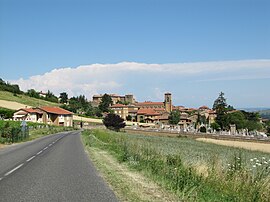 The road into Theizé | |
 Coat of arms | |
show Location of Theizé | |
 Theizé | |
| Coordinates: 45°56′26″N 4°37′02″E / 45.9406°N 4.6172°ECoordinates: 45°56′26″N 4°37′02″E / 45.9406°N 4.6172°E | |
| Country | France |
| Region | Auvergne-Rhône-Alpes |
| Department | Rhône |
| Arrondissement | Villefranche-sur-Saône |
| Canton | Val d'Oingt |
| Government | |
| • Mayor (2020–2026) | Christian Vivier-Merle |
| Area 1 | 11.89 km2 (4.59 sq mi) |
| Population (Jan. 2018)[1] | 1,274 |
| • Density | 110/km2 (280/sq mi) |
| Time zone | UTC+01:00 (CET) |
| • Summer (DST) | UTC+02:00 (CEST) |
| INSEE/Postal code | 69246 /69620 |
| Elevation | 237–601 m (778–1,972 ft) (avg. 4,806 m or 15,768 ft) |
| 1 French Land Register data, which excludes lakes, ponds, glaciers > 1 km2 (0.386 sq mi or 247 acres) and river estuaries. | |


Theizé is a commune in the Rhône department in eastern France.
See also[]
References[]
- ^ "Populations légales 2018". INSEE. 28 December 2020.
| Wikimedia Commons has media related to Theizé. |
| show Authority control |
|---|
This Rhône geographical article is a stub. You can help Wikipedia by . |
Categories:
- Communes of Rhône (department)
- Rhône (department) geography stubs