Taluyers
Taluyers | |
|---|---|
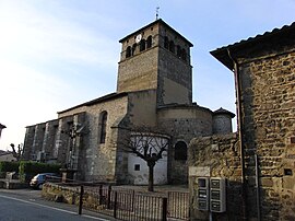 The church in Taluyers | |
 Coat of arms | |
show Location of Taluyers | |
 Taluyers | |
| Coordinates: 45°38′25″N 4°43′22″E / 45.6403°N 4.7228°ECoordinates: 45°38′25″N 4°43′22″E / 45.6403°N 4.7228°E | |
| Country | France |
| Region | Auvergne-Rhône-Alpes |
| Department | Rhône |
| Arrondissement | Lyon |
| Canton | Saint-Symphorien-d'Ozon |
| Intercommunality | |
| Government | |
| • Mayor (2020–2026) | Pascal Outrebon[1] |
| Area 1 | 8.09 km2 (3.12 sq mi) |
| Population (Jan. 2018)[2] | 2,548 |
| • Density | 310/km2 (820/sq mi) |
| Time zone | UTC+01:00 (CET) |
| • Summer (DST) | UTC+02:00 (CEST) |
| INSEE/Postal code | 69241 /69440 |
| Elevation | 205–359 m (673–1,178 ft) (avg. 330 m or 1,080 ft) |
| 1 French Land Register data, which excludes lakes, ponds, glaciers > 1 km2 (0.386 sq mi or 247 acres) and river estuaries. | |


Taluyers is a commune in the Rhône department in eastern France.
See also[]
References[]
- ^ "Répertoire national des élus: les maires". data.gouv.fr, Plateforme ouverte des données publiques françaises (in French). 2 December 2020.
- ^ "Populations légales 2018". INSEE. 28 December 2020.
| Wikimedia Commons has media related to Taluyers. |
This Rhône geographical article is a stub. You can help Wikipedia by . |
Categories:
- Communes of Rhône (department)
- Rhône (department) geography stubs