Daveluyville
Daveluyville | |
|---|---|
City | |
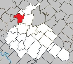 Location within Arthabaska RCM. | |
 Daveluyville Location in southern Quebec. | |
| Coordinates: 46°12′N 72°08′W / 46.200°N 72.133°WCoordinates: 46°12′N 72°08′W / 46.200°N 72.133°W[1] | |
| Country | |
| Province | |
| Region | Centre-du-Québec |
| RCM | Arthabaska |
| Constituted | November 13, 1901 |
| Government | |
| • Mayor | Antoine Tardif |
| • Federal riding | Richmond—Arthabaska |
| • Prov. riding | Nicolet-Bécancour |
| Area | |
| • Total | 2.40 km2 (0.93 sq mi) |
| • Land | 2.23 km2 (0.86 sq mi) |
| Population | |
| • Total | 966 |
| • Density | 432.3/km2 (1,120/sq mi) |
| • Pop 2006-2011 | |
| Time zone | UTC−5 (EST) |
| • Summer (DST) | UTC−4 (EDT) |
| Postal code(s) | G0Z 1C0 |
| Area code(s) | 819 |
| Highways | |
| Website | www |

Daveluyville (/ˌdævəˈlaɪvɪl/)[4] is a city in the Centre-du-Québec region of the Canadian province of Quebec. It was founded by Adolphe Daveluy, the grandfather of organist Raymond Daveluy and soprano Marie Daveluy. It is north of Autoroute 20. Its population was 966 in the Canada 2011 Census.
External links[]
References[]
- ^ Reference number 359245 of the Commission de toponymie du Québec (in French)
- ^ a b Geographic code 39155 in the official Répertoire des municipalités (in French)
- ^ a b "(Code 2439155) Census Profile". 2011 census. Statistics Canada. 2012.
- ^ The Canadian Press (2017), The Canadian Press Stylebook (18th ed.), Toronto: The Canadian Press
Places adjacent to Daveluyville | ||||||||||||||||
|---|---|---|---|---|---|---|---|---|---|---|---|---|---|---|---|---|
| ||||||||||||||||
| Cities |
|
|---|---|
| Municipalities | |
| Parishes |
|
| Townships | |
| |
This Quebec location article is a stub. You can help Wikipedia by . |
Categories:
- Cities and towns in Quebec
- Incorporated places in Centre-du-Québec
- Quebec geography stubs