Division of Canning
| Canning Australian House of Representatives Division | |
|---|---|
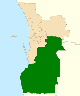 Division of Canning in Western Australia, as of the 2021 redistribution | |
| Created | 1949 |
| MP | Andrew Hastie |
| Party | Liberal Party |
| Namesake | Alfred Canning |
| Electors | 107,182 (2019) |
| Area | 6,304 km2 (2,434.0 sq mi) |
| Demographic | Outer Metropolitan |
The Division of Canning is an Australian Electoral Division in Western Australia.
History[]

The division was created in 1949 and is named for Alfred Canning,[1] the Western Australian government surveyor who surveyed the Canning Stock Route. It was originally a country seat that traded hands between the two main centre-right parties, the Liberal and Country parties.
Since 1980 it has been located in the southern suburbs of the two largest cities in Western Australia, Perth and Mandurah. For most of its last three decades, it has been a highly marginal seat due to the balanced proportion of the urban north and the rural south, changing hands between the Australian Labor Party and the Liberal Party. Canning had a Liberal margin of 4.3 percent leading into the 2010 election,[2] and was targeted by Labor, who stood high-profile candidate and former state Labor MP Alannah MacTiernan.[3] The Liberals retained the seat; however, Canning was the only Western Australian seat to see a two-party preferred swing toward the Australian Labor Party.
A 2015 Canning by-election, triggered on 21 July following the death of Liberal Don Randall, was held on 19 September. Though the Turnbull Government was just four days old, their candidate Andrew Hastie retained the seat for the Liberals, despite having to rely on preferences after a substantial, though dampened, primary (−4.15%) and two-party (−6.55%) swing away from the Liberals − solidly less than the double-digit swings polls had predicted under an Abbott Government − however, some double-digit swings did eventuate among the northern suburban booths. The Canning Liberal margin was reduced from safe to marginal status. Political analysts agreed the by-election was a "good outcome for both major parties".[4]
In 2016, the more urbanised areas of the City of Armadale west of the Albany Highway and South Western Highway, together with the suburbs of Mount Nasura and Kelmscott, were redistributed to the new Division of Burt.[5]
Geography[]
The Division of Canning stretches from Byford and Carmel in the north to Wagerup in the south, and is largely based around the Peel region of Western Australia to the south of Perth.
As at the 2016 election, it includes the entire Peel region, comprising the City of Mandurah and the Shires of Serpentine-Jarrahdale (including Byford and Mundijong), Murray (including Pinjarra, Yunderup and Dwellingup), Waroona (including Waroona and Preston Beach) and Boddington. It also includes suburbs of a more semi-rural nature in the Darling Scarp from the Cities of Armadale, Gosnells, and Kalamunda. In August 2021, the Australian Electoral Commission (AEC) announced that the Shire of Boddington would be transferred from Canning to the seat of O'Connor, while the Gosnells suburbs of Kenwick, Maddington, Orange Grove and part of the Gosnells suburb of Martin would be transferred to Burt. These boundary changes will take place as of the next Australian federal election.[6]
Members[]
| Image | Member | Party | Term | Notes | |
|---|---|---|---|---|---|

|
Len Hamilton (1899–1987) |
Country | 10 December 1949 – 2 November 1961 |
Previously held the Division of Swan. Retired | |

|
Neil McNeill (1921–2009) |
Liberal | 9 December 1961 – 30 November 1963 |
Lost seat. Later elected to the Western Australian Legislative Council in 1965 | |

|
John Hallett (1917–1999) |
Country | 30 November 1963 – 18 May 1974 |
Lost seat | |

|
Mel Bungey (1934–) |
Liberal | 18 May 1974 – 5 March 1983 |
Lost seat | |
|
|
Wendy Fatin (1941–) |
Labor | 5 March 1983 – 1 December 1984 |
Transferred to the Division of Brand | |
|
|
George Gear (1947–) |
Labor | 1 December 1984 – 2 March 1996 |
Previously held the Division of Tangney. Served as Chief Government Whip in the House under Hawke and Keating. Served as minister under Keating. Lost seat | |
|
|
Ricky Johnston (1943–) |
Liberal | 2 March 1996 – 3 October 1998 |
Lost seat | |
|
|
Jane Gerick (1963–2003) |
Labor | 3 October 1998 – 10 November 2001 |
Lost seat | |

|
Don Randall (1953–2015) |
Liberal | 10 November 2001 – 21 July 2015 |
Previously held the Division of Swan. Died in office | |

|
Andrew Hastie (1982–) |
Liberal | 19 September 2015 – present |
Incumbent |
Election results[]
| Party | Candidate | Votes | % | ±% | |
|---|---|---|---|---|---|
| Liberal | Andrew Hastie | 44,580 | 49.05 | −1.25 | |
| Labor | Mellisa Teede | 24,996 | 27.50 | −5.54 | |
| Greens | Jodie Moffat | 6,840 | 7.53 | −1.21 | |
| One Nation | Jackson Wreford | 6,503 | 7.15 | +7.15 | |
| Western Australia | Brett Clarke | 2,554 | 2.81 | +2.81 | |
| United Australia | Steve Veevers | 2,055 | 2.26 | +2.26 | |
| Christians | Jamie Van Burgel | 1,764 | 1.94 | −1.74 | |
| Conservative National | Malcolm Heffernan | 1,600 | 1.76 | +1.76 | |
| Total formal votes | 90,892 | 93.91 | −1.85 | ||
| Informal votes | 5,890 | 6.09 | +1.85 | ||
| Turnout | 96,782 | 90.30 | +1.08 | ||
| Two-party-preferred result | |||||
| Liberal | Andrew Hastie | 55,947 | 61.55 | +4.76 | |
| Labor | Mellisa Teede | 34,945 | 38.45 | −4.76 | |
| Liberal hold | Swing | +4.76 | |||
See also[]
References[]
- ^ "Profile of the electoral division of Canning (WA)". Australian Electoral Commission. Retrieved 11 June 2020.
- ^ http://blogs.abc.net.au/antonygreen/2009/02/final-federal-e.html
- ^ "Archived copy". Archived from the original on 11 October 2009. Retrieved 18 August 2009.CS1 maint: archived copy as title (link)
- ^ Liberal and Labor parties hail success of campaigns: ABC 20 September 2015
- ^ "Redistribution of Western Australia into electoral divisions, January 2016" (PDF). Australian Electoral Commission.
- ^ https://www.aec.gov.au/Electorates/Redistributions/2021/wa/files/redistribution-of-western-australia-into-electoral-divisions-august-2021.pdf
- ^ Canning, WA, Tally Room 2019, Australian Electoral Commission.
External links[]

- Electoral divisions of Australia
- Constituencies established in 1949
- 1949 establishments in Australia
- Federal politics in Western Australia