Division of O'Connor
| O'Connor Australian House of Representatives Division | |
|---|---|
 Division of O'Connor in Western Australia, as of the 2021 redistribution. | |
| Created | 1980 |
| MP | Rick Wilson |
| Party | Liberal |
| Namesake | Charles Yelverton O'Connor |
| Electors | 101,904 (2019) |
| Area | 868,576 km2 (335,359.1 sq mi) |
| Demographic | Rural |
The Division of O'Connor is an Australian electoral division in the state of Western Australia. It is one of Western Australia's three rural seats, and one of the largest electoral constituencies in the world.
History[]
The division was named after Charles Yelverton O'Connor, the Engineer-in-Chief of Western Australia most famously known for designing the Fremantle Harbour and the Goldfields Pipeline. The division was proclaimed at the redistribution of 28 February 1980, and was first contested at the 1980 federal election. It has always been a country seat.
For its first three decades, it took in large portions of the Mid West, Wheatbelt and Great Southern regions of Western Australia with major population centres in Geraldton and Albany. The division was significantly altered by a redistribution in 2008, taking effect at the 2010 election. The other large country seat in Western Australia, Kalgoorlie, already the largest single-member electorate in the world, needed to expand in size. However, it soon became apparent that redistributing Kalgoorlie would have made it all but impossible to reconfigure O'Connor in a way that it would have had any rational basis. Ultimately, it was decided to abolish Kalgoorlie and push O'Connor well to the east to take in most of Kalgoorlie's former southern portion, including the city of Kalgoorlie itself. The northern portion of the old O'Connor was shifted to the new seat of Durack.
It is now centred on the Great Southern and Goldfields-Esperance regions of the state (while incorporating the southern Wheatbelt), with major population centres in Albany, Kalgoorlie and Esperance. Local government areas within the electorate as at the 2016 election include Albany, Boyup Brook, Bridgetown-Greenbushes, Brookton, Broomehill-Tambellup, Bruce Rock, Collie, Coolgardie, Corrigin, Cranbrook, Cuballing, Denmark, Dumbleyung, Dundas, Esperance, Gnowangerup, Jerramungup, Kalgoorlie-Boulder, Katanning, Kent, Kojonup, Kondinin, Kulin, Lake Grace, Laverton, Leonora, Manjimup, Menzies, Narembeen, Narrogin, Ngaanyatjarraku, Pingelly, Plantagenet, Ravensthorpe, Wagin, Wandering, West Arthur, Wickepin, Williams and Woodanilling.[1]
In August 2021, the Australian Electoral Commission (AEC) announced that O'Connor would receive the Wheatbelt Shires of Bruce Rock, Cunderdin, Kellerberrin, Koorda, Kulin, Meekatharra, Merredin, Mount Marshall, Mukinbudin, Narembeen, Nungarin, Quairading, Tammin, Trayning, Westonia, Wyalkatchem and Yilgarn and the Mid West Shire of Wiluna from the seat of Durack, while it would also receive the Wheatbelt Shire of Beverley from the seat of Pearce and the South West Shires of Boddington and Nannup from the seats of Canning and Forrest, respectively. These boundary changes will take place as of the next Australian federal election.[2]
The seat has always been held by a conservative party. When it was created, its demographics suggested that it should have been held by the National Country Party, despite its large notional Liberal majority. However, severe conflict between rival branches of the state National Party allowed Liberal Wilson Tuckey to take the seat on Labor preferences.[3][4] Tuckey held it without serious difficulty until his defeat at the 2010 election by Nationals WA candidate Tony Crook with a large swing. However, the Liberals regained the seat at the 2013 election.
Members[]
| Image | Member | Party | Term | Notes | |
|---|---|---|---|---|---|

|
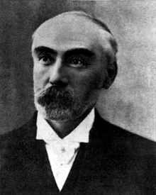
Wilson Tuckey (1935–) |
Liberal | 18 October 1980 – 21 August 2010 |
Served as minister under Howard. Lost seat | |

|
Tony Crook (1959–) |
Nationals WA | 21 August 2010 – 5 August 2013 |
Retired | |

|
Rick Wilson (1966–) |
Liberal | 7 September 2013 – present |
Incumbent |
Election results[]
| Party | Candidate | Votes | % | ±% | |
|---|---|---|---|---|---|
| Liberal | Rick Wilson | 36,135 | 42.04 | −0.63 | |
| Labor | Shelley Payne | 18,243 | 21.22 | +0.30 | |
| National | John Hassell | 10,795 | 12.56 | −5.77 | |
| One Nation | Dean Smith | 7,252 | 8.44 | +8.44 | |
| Greens | Nelson Gilmour | 7,245 | 8.43 | −1.94 | |
| Christians | Ian 't Hart | 2,527 | 2.94 | −1.08 | |
| United Australia | Anthony Fels | 1,598 | 1.86 | +1.86 | |
| Western Australia | Peter Swift | 1,279 | 1.49 | +1.49 | |
| Great Australian | Nicholas Robinson | 883 | 1.03 | +1.03 | |
| Total formal votes | 85,957 | 93.69 | −2.50 | ||
| Informal votes | 5,785 | 6.31 | +2.50 | ||
| Turnout | 91,742 | 90.03 | +1.24 | ||
| Two-party-preferred result | |||||
| Liberal | Rick Wilson | 55,421 | 64.48 | −0.56 | |
| Labor | Shelley Payne | 30,536 | 35.52 | +0.56 | |
| Liberal hold | Swing | −0.56 | |||
References[]
- ^ "Profile of the electoral division of O'Connor (WA)". Australian Electoral Commission.
- ^ https://www.aec.gov.au/Electorates/Redistributions/2021/wa/files/redistribution-of-western-australia-into-electoral-divisions-august-2021.pdf
- ^ "O'Connor - Australia Votes Federal Election 2013". Abc.net.au. Retrieved 21 March 2017.
- ^ http://psephos.adam-carr.net/countries/a/australia/1980/1980repswa.txt
- ^ O'Connor, WA, Tally Room 2019, Australian Electoral Commission.
External links[]

- Electoral divisions of Australia
- Constituencies established in 1980
- 1980 establishments in Australia
- Federal politics in Western Australia