Shire of Ravensthorpe
| Shire of Ravensthorpe Western Australia | |||||||||||||||
|---|---|---|---|---|---|---|---|---|---|---|---|---|---|---|---|
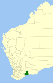 Location in Western Australia | |||||||||||||||
| Population | 1,733 (2016 census)[1] | ||||||||||||||
| • Density | 0.12789/km2 (0.33122/sq mi) | ||||||||||||||
| Area | 13,551.1 km2 (5,232.1 sq mi) | ||||||||||||||
| President | Keith Dunlop | ||||||||||||||
| Council seat | Ravensthorpe | ||||||||||||||
| Region | Goldfields-Esperance | ||||||||||||||
| State electorate(s) | Roe | ||||||||||||||
| Federal Division(s) | O'Connor | ||||||||||||||
| Website | Shire of Ravensthorpe | ||||||||||||||
| |||||||||||||||
The Shire of Ravensthorpe is a local government area in the southern Goldfields-Esperance region of Western Australia, about halfway between the city of Albany and the town of Esperance and about 530 kilometres (329 mi) southeast of the state capital, Perth. The Shire covers an area of 13,551 square kilometres (5,232 sq mi), and its seat of government is the town of Ravensthorpe.
History[]
The Phillips River Road District was gazetted on 9 November 1900. On 1 July 1961, it became the Shire of Ravensthorpe under the Local Government Act 1960, which reformed all remaining road districts into shires.[2]
Wards[]
As of the 2003 election, the Shire is divided into three wards:
- Ravensthorpe Ward (two councillors)
- Hopetoun Ward (two councillors)
- Rural Ward (three councillors)
Towns and localities[]
Heritage-listed places[]
As of 2021, 122 places are heritage-listed in the Shire of Ravensthorpe,[3] of which one is on the State Register of Heritage Places, the Metropolitan Hotel in Hopetoun.[4]
References[]
- ^ Australian Bureau of Statistics (27 June 2017). "Ravensthorpe (S)". 2016 Census QuickStats. Retrieved 26 November 2017.

- ^ "Municipality Boundary Amendments Register" (PDF). Western Australian Electoral Distribution Commission. Retrieved 11 January 2020.
- ^ "Shire of Ravensthorpe Heritage Places". inherit.stateheritage.wa.gov.au. Heritage Council of Western Australia. Retrieved 8 February 2021.
- ^ "Shire of Ravensthorpe State Register of Heritage Places". inherit.stateheritage.wa.gov.au. Heritage Council of Western Australia. Retrieved 8 February 2021.
External links[]
| show Authority control |
|---|

- Local government areas of the Goldfields-Esperance region of Western Australia
- Shire of Ravensthorpe