Shire of Dandaragan
| Shire of Dandaragan Western Australia | |||||||||||||||
|---|---|---|---|---|---|---|---|---|---|---|---|---|---|---|---|
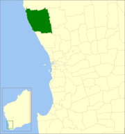 Location in Western Australia | |||||||||||||||
 | |||||||||||||||
| Population | 3,213 (2016 census)[1] | ||||||||||||||
| • Density | 0.47839/km2 (1.23902/sq mi) | ||||||||||||||
| Established | 1890 | ||||||||||||||
| Area | 6,716.3 km2 (2,593.2 sq mi) | ||||||||||||||
| Shire President | Leslee Holmes | ||||||||||||||
| Council seat | Jurien Bay | ||||||||||||||
| Region | Wheatbelt | ||||||||||||||
| State electorate(s) | Moore | ||||||||||||||
| Federal division(s) | Durack | ||||||||||||||
| Website | Shire of Dandaragan | ||||||||||||||
| |||||||||||||||
The Shire of Dandaragan is a local government area located in the Wheatbelt region of Western Australia, about 200 kilometres (124 mi) north of the state capital, Perth. The Shire covers an area of 6,716 square kilometres (2,593 sq mi) and its seat of government is the town of Jurien Bay.
History[]
The Dandaraga Road District was created on 27 February 1890. It was renamed the Dandaragan Road District on 22 July 1932. On 1 July 1961, it became a shire following the enactment of the Local Government Act 1960, which reformed all remaining road districts into shires.[2]
Until the late 1960s it was a sparsely populated agricultural shire, but the coastal towns of Jurien Bay and Cervantes and the popularity of The Pinnacles Desert with tourists have helped to fuel the Shire's growth. Originally the Shire's main administration centre was in the small town of Dandaragan, however due to the disproportionate population growth in the town of Jurien Bay the administration was relocated there in 2003.
Wards[]
On 22 May 1971, the shire was divided into Coastal, Central, North and South wards, and its representation increased from seven to nine councillors.[3] Over time, the Coastal ward increased in size, and ultimately on 2 May 1987, the ward was abolished and two new wards, Cervantes and Jurien, were created.[4] By 3 November 1989, the following wards existed:[2]
- Jurien Ward (three councillors)
- Cervantes Ward (two councillors)
- Badgingarra Ward (two councillors) (formerly North Ward)
- Dandaragan Ward (three councillors) (formerly South Ward)
On 7 May 2005, the shire was redivided into two wards:
- North Ward (five councillors)
- South Ward (four councillors)
By the 2009 Council elections all wards had been abolished and nine councillors represent the whole shire.
Towns and localities[]
- Badgingarra
- Boothendarra
- Cataby
- Cervantes
- Cooljarloo
- Dandaragan
- Grey
- Jurien Bay
- Mimegarra
- Nambung National Park
- Regans Ford
- Wedge Island
- Yathroo
Population[]
| Year | Population |
|---|---|
| 1911 | 269 |
| 1921 | 222 |
| 1933 | 240 |
| 1947 | 191 |
| 1954 | 303 |
| 1961 | 456 |
| 1966 | 619 |
| 1971 | 1,345 |
| 1976 | 1,709 |
| 1981 | 1,785 |
| 1986 | 2,128 |
| 1991 | 2,363 |
| 1996 | 2,570 |
| 2001 | 2,988 |
| 2006 | 2,884 |
| 2011 | 3,185 |
| 2016 | 3,213 |
Heritage-listed places[]
As of 2021, 97 places are heritage-listed in the Shire of Dandaragan,[5] of which none are on the State Register of Heritage Places.[6]
References[]
- ^ Australian Bureau of Statistics (27 June 2017). "Dandaragan (S)". 2016 Census QuickStats. Retrieved 1 December 2017.

- ^ a b "Municipality Boundary Amendments Register" (PDF). Western Australian Electoral Distribution Commission. Retrieved 11 January 2020.
- ^ "Local Government Act 1960 - Shire of Dandaragan - Wards and Membership. Order in Council. (per L.G. 421/68)". Western Australia Government Gazette. 26 March 1971. p. 1971:976.
- ^ "Local Government Act 1960 - Shire of Dandaragan (Ward Boundaries and Representation) Order 1987". Western Australia Government Gazette. 9 January 1987. p. 1987:43–44.
- ^ "Shire of Dandaragan Heritage Places". inherit.stateheritage.wa.gov.au. Heritage Council of Western Australia. Retrieved 25 March 2021.
- ^ "Shire of Dandaragan State Register of Heritage Places". inherit.stateheritage.wa.gov.au. Heritage Council of Western Australia. Retrieved 25 March 2021.
External links[]

- Populated places established in 1890
- 1890 establishments in Australia
- Shire of Dandaragan
- Local government areas of the Wheatbelt region of Western Australia