Shire of Carnarvon
| Shire of Carnarvon Western Australia | |||||||||||||||
|---|---|---|---|---|---|---|---|---|---|---|---|---|---|---|---|
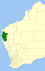 Location in Western Australia | |||||||||||||||
 | |||||||||||||||
| Population | 5,528 (2016 census)[1] | ||||||||||||||
| • Density | 0.118465/km2 (0.306823/sq mi) | ||||||||||||||
| Established | 1965 | ||||||||||||||
| Area | 46,663.5 km2 (18,016.9 sq mi) | ||||||||||||||
| Shire President | Eddie Smith | ||||||||||||||
| Council seat | Carnarvon | ||||||||||||||
| Region | Gascoyne | ||||||||||||||
| State electorate(s) | North West | ||||||||||||||
| Federal division(s) | Durack | ||||||||||||||
| Website | Shire of Carnarvon | ||||||||||||||
| |||||||||||||||
The Shire of Carnarvon is a local government area in the Gascoyne region of Western Australia, located about 900 kilometres (560 mi) north of the state capital, Perth. The Shire covers an area of 46,664 square kilometres (18,017 sq mi), and its seat of government is the town of Carnarvon. The major industries in the area are wool, agriculture (especially bananas and tomatoes) and, more recently, tourism.
History[]
The Shire of Carnarvon was established on 12 February 1965 with the amalgamation of the Town of Carnarvon and the surrounding Shire of Gascoyne-Minilya.[2]
Bernier Island, Dorre Island and Koks Island were included in the shire on 3 December 1982.[2]
Wards[]
The Shire is divided into 4 wards, most of which have one councillor. The Shire President is directly elected.
- Town Ward (6 councillors)
- Plantation Ward
- Gascoyne/Minilya North
- Gascoyne/Minilya South
Towns and localities[]
Notable councillors[]
- Dudley Maslen, Shire of Carnarvon councillor 1975–1988; later a state MP
Heritage-listed places[]
As of 2021, 110 places are heritage-listed in the Shire of Carnarvon,[3] of which 14 are on the State Register of Heritage Places.[4]
References[]
- ^ Australian Bureau of Statistics (27 June 2017). "Carnarvon (S)". 2016 Census QuickStats. Retrieved 26 November 2017.

- ^ a b "Municipality Boundary Amendments Register" (PDF). Western Australian Electoral Distribution Commission. Retrieved 11 January 2020.
- ^ "Shire of Carnarvon Heritage Places". inherit.stateheritage.wa.gov.au. Heritage Council of Western Australia. Retrieved 6 March 2021.
- ^ "Shire of Carnarvon State Register of Heritage Places". inherit.stateheritage.wa.gov.au. Heritage Council of Western Australia. Retrieved 6 March 2021.
External links[]

- Populated places established in 1965
- 1965 establishments in Australia
- Shire of Carnarvon
- Local government areas of the Gascoyne region of Western Australia